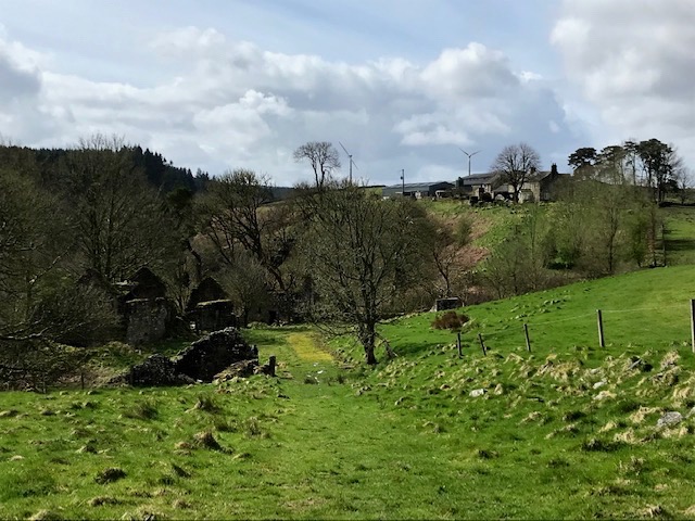
A linear ramble on Sunday along a nearby burn was long overdue. Starting with a mooch around a distinctive abandoned farmhouse and outbuildings, more ruinous as each year passes, teetering on the cliff edge above the burn below.
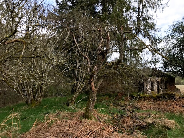
Descended to cross the river via a wooden footbridge, the land opened up again, and we’re at the melancholy ruined cottage overlooking a deep pool. In summer the bracken here is waist high but now the path is bare and muddy. The cottage garden has stands of gleaming hazel, once coppiced but no longer. A magnificent holly tree stands guard over the ruins.
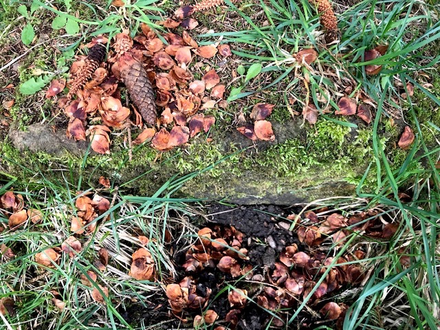
Inside the shell of the roofless building sycamores and a handful of tall pines also grow unhindered. Kielder forest is estimated to be home to half of England’s endangered red squirrel population and we saw evidence of their dining on a fallen stone, re-used as their dining table. The pinecones they feast upon easily sourced from the trees above.
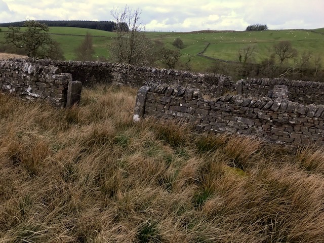
We ascended the fell side, following a thin path, little more than a sheep trod, through swathes of bleached grasses, over boggy patches where rivulets drain to the burn below. We paused at a large rectangular stell, or sheep pen. Seemingly no longer used, its dry stone walls still in good order, strands of barbed wire across the entrance.
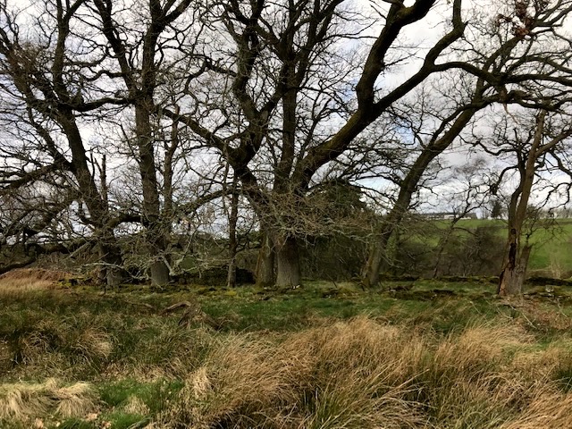
Later we admired a fine stand of oaks bordered on the far side by river gorge and on ours by a dry stone wall, mossed over and tumbled down. The grove must have been planted at least a century or so ago, securing it from disturbance.
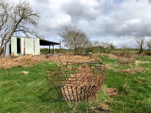
A trio of exuberant metal strap structures we encountered were fascinating. Can’t make up my mind whether they were improvised ring feeders, where hay is dropped for stock, or an elaborate protection for growing saplings to save them being grazed by deer, sheep or cattle.
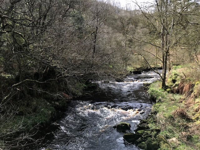
When our path joined the Pennine Way, we followed the broader track back down into the sandstone gorge to cross the fierce flowing peaty waters once again. The valley’s steep sides retain great value as vertical nature reserves, sustaining mature trees and shrubs, refuges for wildlife from bad weather and sheep grazing.
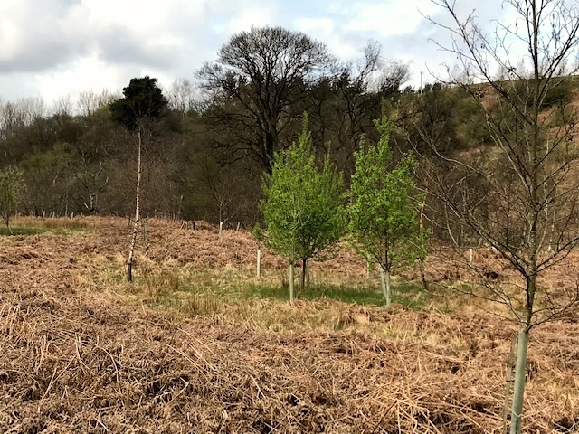
Here in the valley bottom three years ago we talked with the farmer and his brother-in-law who were planting and staking rowan, oak and hazel as part of their higher stewardship commitment. Those trees are now well established and growing on well. Very satisfying to see the woodland extended and welcomed back into the valley like this. All credit to them for the work. This time around we met and chatted with a lone walker of similar vintage to ourselves, coming up at pace behind as we slowly climbed the bank. Turned out he had motor biked it over from home near Chorley in Lancashire that morning, parked up at Housesteads fort on the Roman Wall and was doing a ten mile circular walk before heading home again.
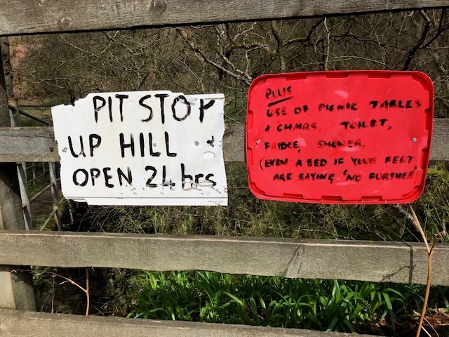
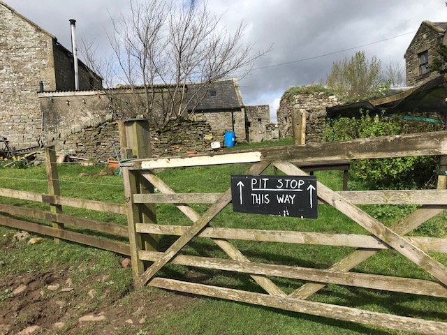
Anyone who has walked or run the trail at this point knows about the ‘pitstop’ at the farm here that overlooks the gorge (site of a listed 16th century bastle or fortified house). This extraordinary help yourself ‘service station’ in the barn is open 24 hours.
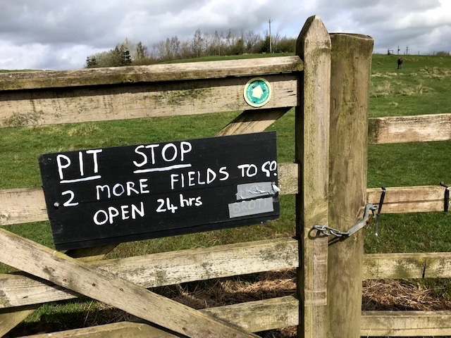
A godsend for many a weary long distance wayfarer. I’ve also written about it in an earlier diary; ‘Pitstop’ January 19th 2023.

Hi Steve, I’m inclined to think that the metal structures are hay feeders from the time when hay was cocked in the field. Place these things around a cock and fence off the rest of the field. Then the sheep would be able to eat the hay and none of it would get wasted or blow away in the wind. When empty, move the temporary fence and put this ‘basket’ around the adjacent cock…
LikeLike
Thank you Pascal….further conversation with folk here would support that conclusion!
LikeLike