Bremenium

Thought I’d celebrate being 75 last week by taking a walk at a place often driven past while heading over the border via Carter Bar. We started at ‘The Last Café in England’, something of a local institution, on the A68 in Rochester village. Coffees with a bacon butty, made deli style with focaccia bread, set us up nicely for the afternoon ahead. The café’s handsome resident hens are a law unto themselves as they weave in and out of customers, but I liked their casual audacity of their panhandling approach.

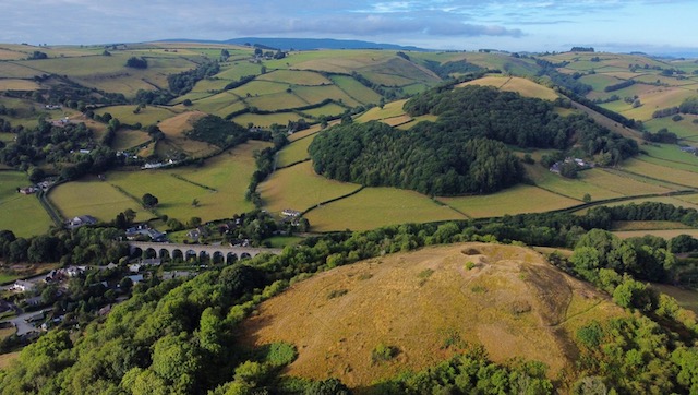
I’d called in here for the first time earlier this year returning from a social trip north and on that occasion discovered the neighbouring interpretation centre, a contemporary structure of wood and stone. (exterior, above) It gives an overview of the early history of Upper Redesdale, centred around the Roman fort, or rather series of forts, situated on the slopes above from 80 AD to AD 340 when it was abandoned.

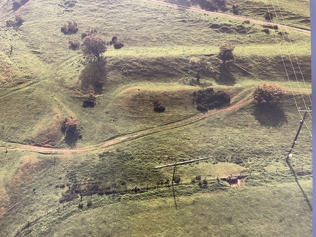
LIDAR image of Bremenium at the interpretation centre

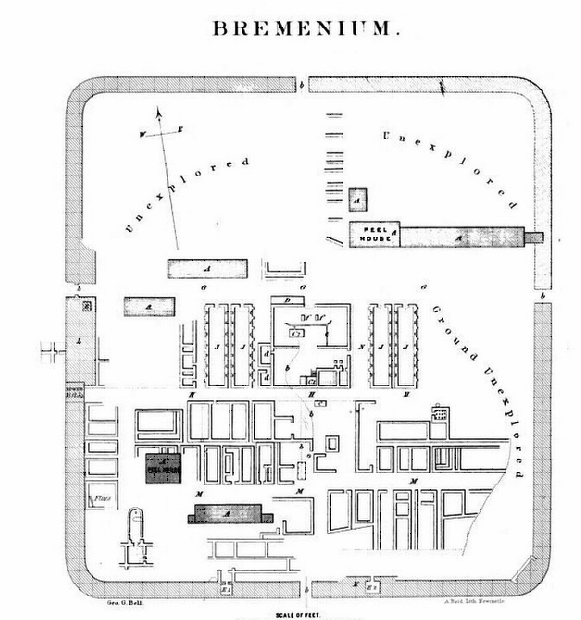
Bremenium fort stood guard over their cross border highway, known since the middle ages as Dere Street, and roughly aligned with the A68 today, which linked the Roman towns of Corbridge (Corstopitum) to the south and Melrose (Trimontium) to the north. That first fort, founded by the great Roman general Agricola, preceded the building of Hadrian’s wall by some 50 years. It was a vital logistical base and stopping off point on the  supply route that spearheaded their invasion of what is now Scotland. When the legions later withdrew Bremenium’s importance only grew as the most northerly permanent outpost of the empire. At its peak up to 1,000 men were stationed here; infantry, auxiliaries, scouts, cavalry as well as all those who supplied their needs in the civilian vicus and beyond.

We ambled along the lane that leads up to High Rochester, and the hamlet within what was Bremenium. Like Hadrian’s wall and other Roman sites it would be robbed of its vast resource of dressed stone in the centuries that followed the legions departure from Britannia in AD 410.

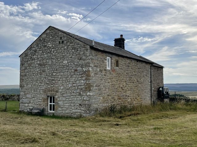
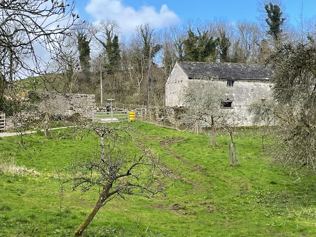
By the C16th our region would became notorious for cross border cattle raids by marauding native clans known as the Border Reivers. In 1581 a particularly bad incursion from Scotland laid waste to High Rochester. We could see that at least one of the existing buildings on the old fort site was originally a bastle, (above) a fortified stone house where animals and people were barricaded in during Reiver raids.

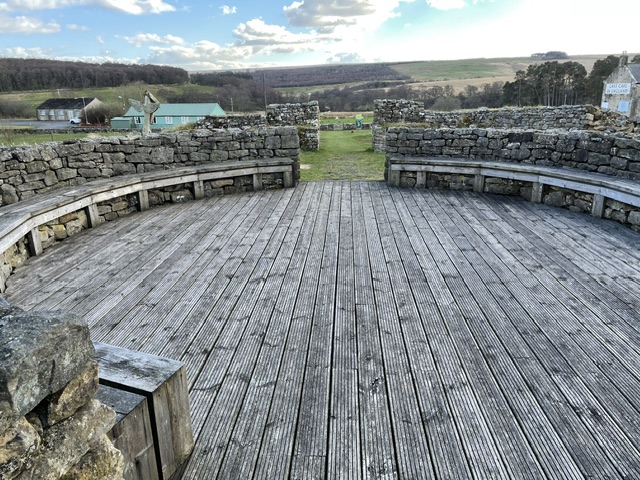
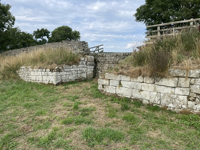
Later, after the union of the Crowns in 1603, what passed for peace and and the re-establishment of the rule of law slowly returned to these borderlands. That speeded up the fabric recycling process and most of what stone was left of the fort vanished from view only to reappear in the form of the houses, farms, cottages and barns scattered across this wild rugged landscape. The most impressive remains (above) are of the stout western walls and gateway, accessed by footpath from the lane.

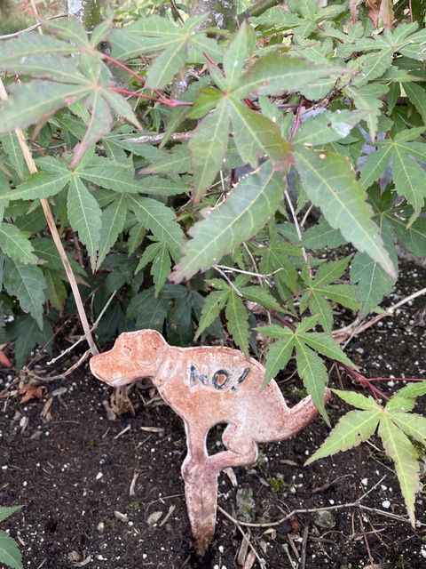
A hot day, with a gentle breeze to cool us as we left the site for even higher ground. In the neighbouring field a stone waller was plying his ancient craft, under the shade of a small gazebo. Our metalled road became a gritted track then a grass path through rough pasture, leading to a farmhouse entrance with a cautionary sign for passing dog walkers…

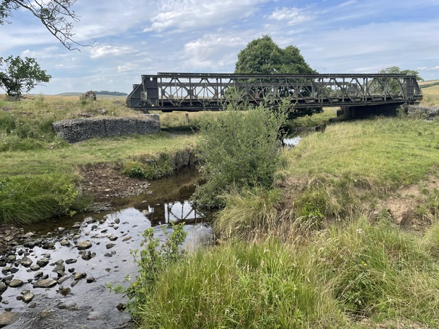
Here on the edge of conifer forest we emerged on to extra wide gritted trackways. On one side of us lay the 93 acres of the Otterburn live firing ranges (a quarter of the national park) which have played a key role in training the military since 1911. On the other side is the 250 square miles of Kielder forest, the country’s biggest commercial softwood resource. Military vehicles and timber trucks both require this standard of roadway to get about. We had our mid walk snacks where an impressive metal cantilever bridge crossed the Sills burn, the little river in its steep sided valley, and the ‘place of the rushing waters’ that gave Bremenium its name.

Image: Great North Museum / Carole Raddato

One of the highlights of the Great North Museum in Newcastle is a deep relief stone frieze of Venus and attendant water nymphs which was found fronting  a water tank in the commander’s quarters in 1855. Its mix of Roman and Celtic styles makes it particularly engaging…Hard to  imagine the goddess and her attendants taking a dip here today though.

A little further on we crossed the line of  Dere Street. To our right, heading arrow straight into the firing ranges and Scotland beyond, was a well-kept road for farm, forestry and military access. But to our left a trace of pathway and the odd paved stone protruding from rush covered grazing were the only signs that the old Roman road had ever ran through there. The path’s dislodged weather beaten interpretive sign seemed to say it all.

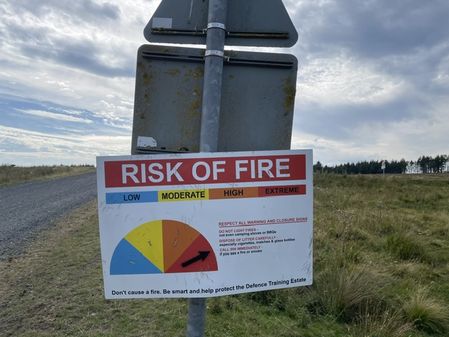
Another sign we had to take notice of though was this one. Someone must have been out recently to set the dial at extreme risk of fire. Earlier when walking downhill through the forest we’d seen beaters lined up by the roadside, ready to be enlisted in putting out any nascent flames. Mindful of images of recent devastating wild fires elsewhere in the UK and on the continent, the sign was a suitably sobering reminder of seasonal danger.

At this point in our ramble opinions differed as to the return leg of our route. Our Northumberland National Park guidebook (published 1996) had got us into trouble before. A walk above Falstone last year promised a fine view over Kielder water from its highest point, but when we got there the subsequent conifer growth had completely blocked any vista. Similarly, this walk advised returning to Rochester by following the marked OS footpath between forest and stream. I was all for following the green dots, even though no sign of any path existed, while Kim favoured either going back the way we’d come or carrying on along the track to gain the A68 north of Rochester and loop back the long way.

She was reluctantly persuaded to opt for my route. Setting off we quickly found ourselves in the roughest of rough grazing before clambering through a bank of forest fringe, ducking under low sweeping branches. A relief to come across a style in the fence and some footprints. Traversing the steep sloping field ahead, full of chest high bracken, wasn’t the most encouraging of prospects. Making instead for gaps where they existed, we zigzagged on open ground, heading for the eminence of Bremenium ahead, with a visible path curling up to it, over the humps and bumps that are the remains of defensive ditches. Eventually then we got there, much to my relief. Kim said nothing, clearly not best impressed with my boys’ own spirit in pursuing the lost footpath that the guide book had directed us along.

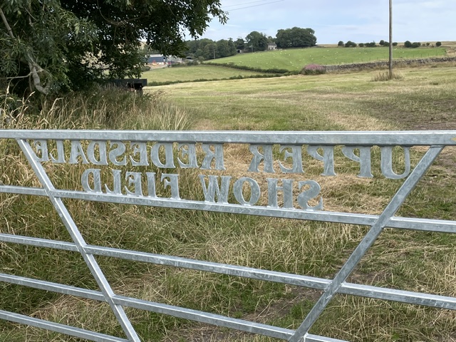
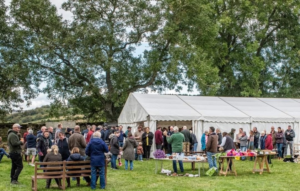
Today a corner of Bremenium, bounded on this west side by the remnants of its thick wall foundations, is home to the annual Upper Redesdale Show Society who put on the Rochester Show on the last Saturday in September. The 2026 event will be their 135th gathering.
A rural community celebration and a far cry from the blood and guts history of the area. I pulled in at the Redesdale Arms for a refreshing pint in the garden overlooking the dale at its tranquil summer best. We relaxed in the late sun and had a laugh about that last leg scramble of a ramble. Once home the old guide book was duly consigned to the recycling bin. From now on, when walking in this neck of the woods, we’ll be using the up to date guides supplied by the Revitalising Redesdale Community Partnership. https://www.revitalisingredesdale.org.uk/

Rochester Show 2025

Sizergh The Day

I’ve visited a lot of National Trust properties during my adult life. In the 1980s & 1990’s it was as an actor/researcher with their young people’s theatre company, devising and staging immersive dramas. More recently I was a welcome host then garden volunteer at Cherryburn, the Tyne valley farm that was Thomas Bewick’s childhood home. But it’s as an ordinary member that I’d rate a day spent on the Sizergh Castle estate near Kendal in Westmorland as one of the most coherent and harmonious of visitor experiences.

This happy outcome was due to an ideal combination of activities. A fine walk with varied views, seasonal garden delights and characterful castle interiors, rounded off with sampling the scones offer in the café.

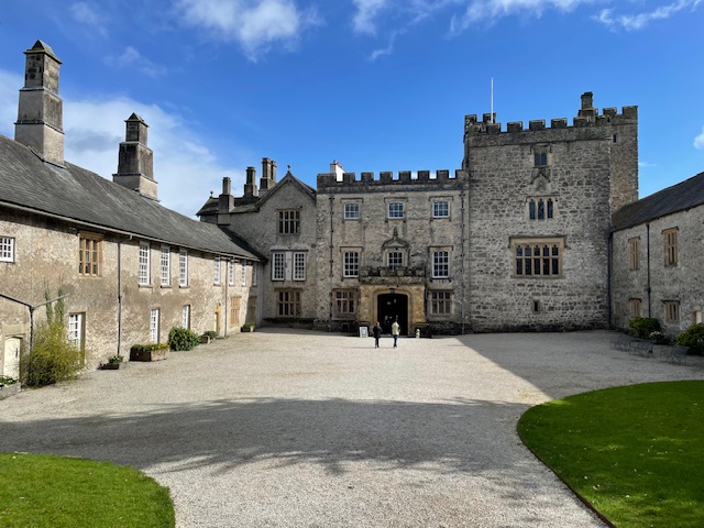
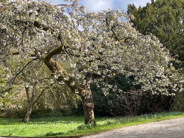
The Sizergh estate came to the National Trust in 1950 after centuries in the ownership of one family, the Stricklands, whose Anglo-Norman ancestors inherited it through marriage in 1239. The family still retain part of the house as their private home. The 1,600 acre (647 hectare) estate is commercially farmed by tenants while rangers develop and manage nature restoration and greater access projects in and around the agricultural framework.  

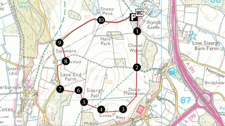
The well signposted Sizergh Fell trail provided lots of interest.  At the 400’ summit, overlooking Morecambe Bay to the south,  we came across remains of neolithic burial sites and traces of Romano-British settlements peeping through cropped turf and brambles at the edge of a huge swathe of tussocky anthills. Traditional British breeds of beef cattle are kept here, well adapted to this kind of upland grazing. Fittingly, the old English derivation of the name Strickland apparently means bullock pasture.
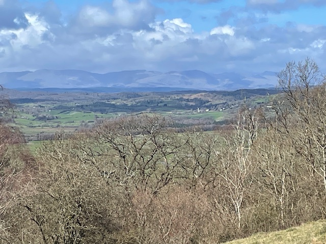
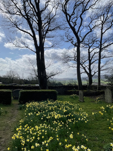
The track dips then rises to follow the limestone ridge, yielding fine views across the Lyth valley levels up into the mountainous heart of the Lake District. A brief ferocious hail storm cleared the grey clouds and let some sunshine in. Emerging from Brigsteer woods we  found ourselves at  Helsington Church, sheltered by its tree bordered burial ground now carpeted by daffodils and white starred wood anemones.

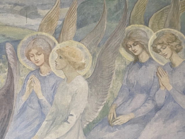
Inside the modest  light filled  interior the Georgian church’s distinctive decorative feature is wonderfully revealed…A whole wall depiction of supplicant female angels in a setting of Lakeland fells framing the altar below.

Dating from 1919, the painting commemorates those who gave their lives in the Great War.  Along with the altar paintings depicting flowers and other motifs, it was the work of a  female artist  who lodged at Sizergh Castle, Marion de Saumarez (1885-1978). Executed in oils on canvas the composition was stretched on battens and secured to the wall.

On our gradual descent back to the start we appreciated  the quality work put in by the rangers to make this circular trail so user friendly.

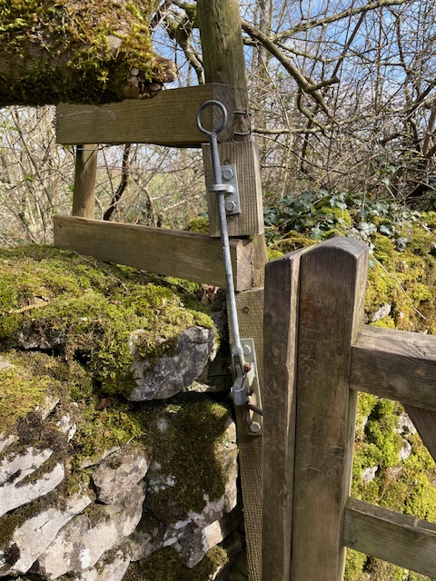
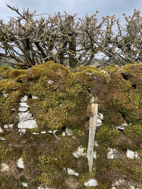
From  bespoke gate latches  to the  limestone dry stone walls strengthened by through ties of metal wire and wood block. This particularly thick wall also had extra stock proofing on the field side in the form of blackthorn hedging, which was just now coming into flower.

Down at Holeslack farm (now holiday accommodation) new laid hedges framed a damson orchard. In the old barn were bundles of hazel rods harvested from the neighbouring wood, no doubt to be used in hedge laying and other tasks about public parts of the estate.

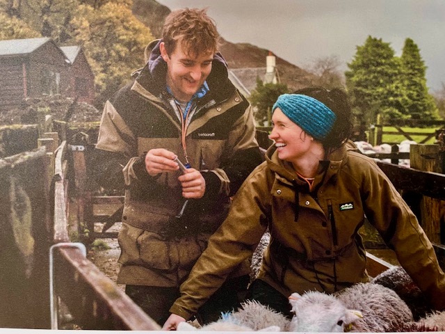
The building is also playing host to a temporary exhibition celebrating the often undervalued and overlooked role of women in upland hill farming in the 21st century. Illustrated by great images of said women at work on their farms, their number including profiled chroniclers of rural life like Andrea Meanwell (Tebay) and Helen Rebanks (Matterdale).

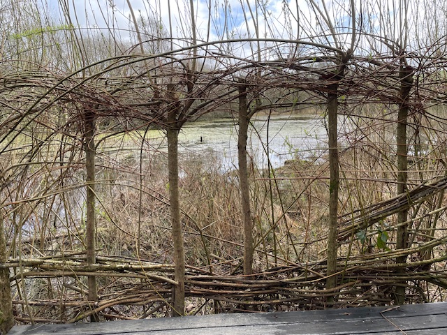
A walk through Holeslack woods revealed the wide paths and smooth surface to allow buggies and wheelchairs easy access. Dogs Mercury – an indicator of ancient woodland – is here in abundance. A branching path led us to a platform overlooking a wildlife pond on the woodland’s lowest edge, framed by arches of live willow wands. A nice touch.

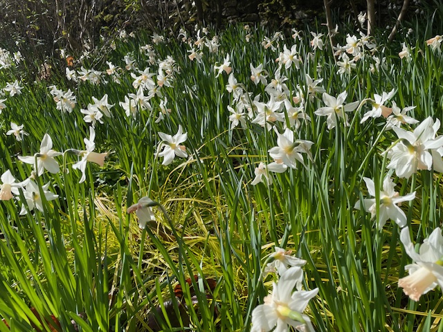
The gardens at Sizergh are a delight. Conversations with one of the gardeners about the narcissi as we strolled through gave extra pleasure to the discoveries.

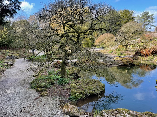
The wide borders, cordons of pears against orchard walls, herb beds framed and sheltered by reflective slate; an extensive sunken limestone rockery with pools, shrubs, trees and alpines giving way to large formal ponds, steps and terraces that frame the castle’s impressive south elevation.

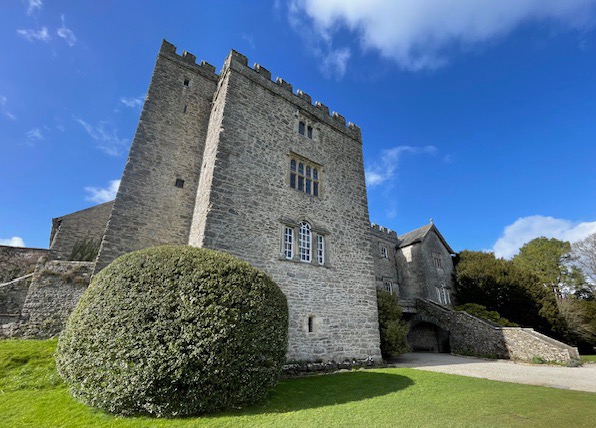
The castle core is the most impressive architectural feature to my eyes.. That’s the oldest section, the 60’ high C14th Pele or Solar tower. It also has the original spiral staircase which the little boy  inside me was quietly thrilled to descend at the end of our visit.

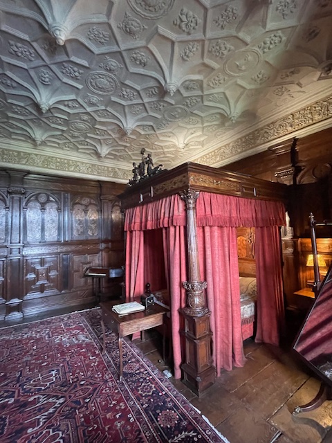
Inside the great square tower and its elegant Jacobean extension the takeaway impression is of dark oak floors and wall panels punctuated by huge sculpted fire surrounds within massively thick walls, enlightened and enriched by fine furniture and hangings. There are also generations of family portraits, alongside those of the Stuart monarchs many of them served. So close an association in fact that Thomas Strickland was forced into exile in France alongside fellow catholic James II after the Glorious revolution of 1688, never to return. His successors were fortunate to retrieve the family seat after protracted legal action.

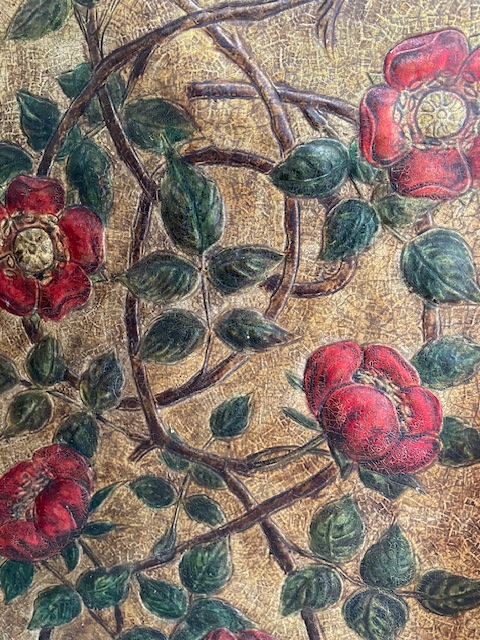
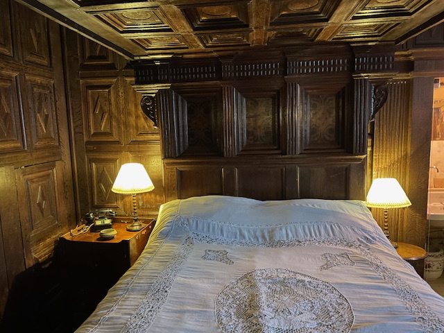
In the 1890’s another dip in fortunes saw the selling off of the inlaid wainscoting that gave the Elizabethan bedroom at the top of great tower its name. A very rare survivor in a country house of oak panelling inlaid with pale poplar in floral and geometric patterns. London’s V&A museum had bought the panels from the family and displayed them throughout the 20th century. The story gets a happy ending when the NT and the V&A struck a deal, facilitating their refit in aitu in the 21st century.  We’d like to return too, to experience the garden in another season and explore those parts of the wider estate we’d not had time to discover this time around.

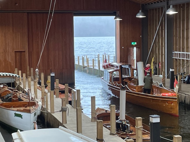
Footnote: returning home next day the weather turned  truly elemental in a way that only Cumbrian weather can. We spent a happy morning out of the biblical deluge, enchanted by the Windermere Jetty Museum in its impressive architect designed home on the lake at Bowness. It houses an extraordinary collection of craft associated with Lakeland waters and also offers – weather permitting – trips aboard steam powered vessels on Windermere.

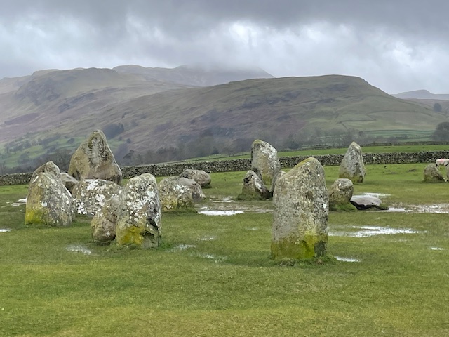
What really made our day though was when we eventually got to Castlerigg. Situated on a shoulder of hillside, between Keswick and the town’s neighbouring mountains this impressive stone circle is estimated to be some 3,000 years old.
Rediscovered by romantic era influencers of the early C19th like Wordsworth and Burns this mysterious round of huge stones then stood marooned within a ploughed field. The most likely reason the circle’s single stone outlier was moved and repositioned in a corner of the field was to ease passage for the plough and team. The ghosted form of rigg and furrow (ridge & furrow) is still evident  in the flattened corrugated ground. A challenge to stay upright when fiercely buffeted by fierce wind and rain but the effect was extra spectacular and – more selfishly – the weather helped keep this spell binding picture free of fellow humans for a while!

Vouga voyage

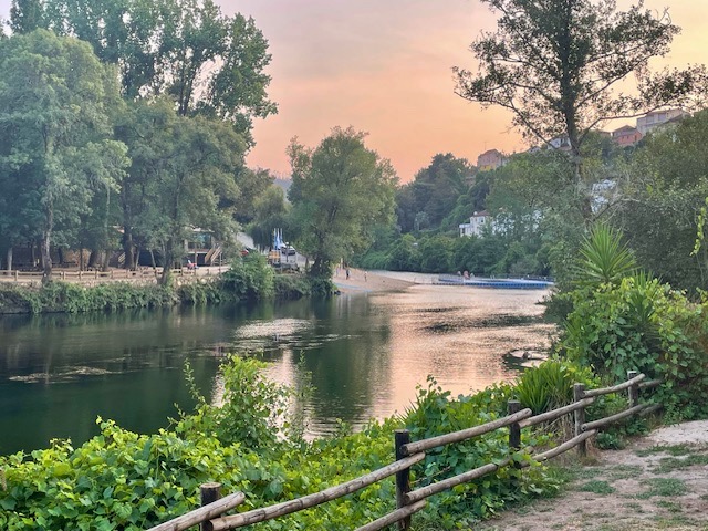
Recently returned from a week’s holiday in the valley of the River Vouga, mid-way between its outlet at Aveiro on the coast and the city of Viseu near its source in the Serra Lapa.

Like the other major rivers of Portugal The Vouga runs its 148 KM course from east in the mountains to the Atlantic in the west. It was once a major transport route for countryside produce; from wines, granite, metals and timber to fruit and other agricultural produce. (In the 17th Century most of their oranges were exported to England) By 1913, a train line had replaced the inland river boats, which in turn gave way to EU funded new roads that twist and turn above the Vouga’s sinuous green waterways. We enjoyed three separate outings sampling distinctive phases of the river’s flow and topography.

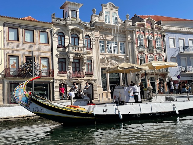
Took a fun day out to swell the ranks of other tourists milling around ‘The Venice of Portugal’, as the city centre of old Aveiro is dubbed. A major port in late medieval times it later became famous for commercial salt abstraction, fishing and seaweed harvesting.

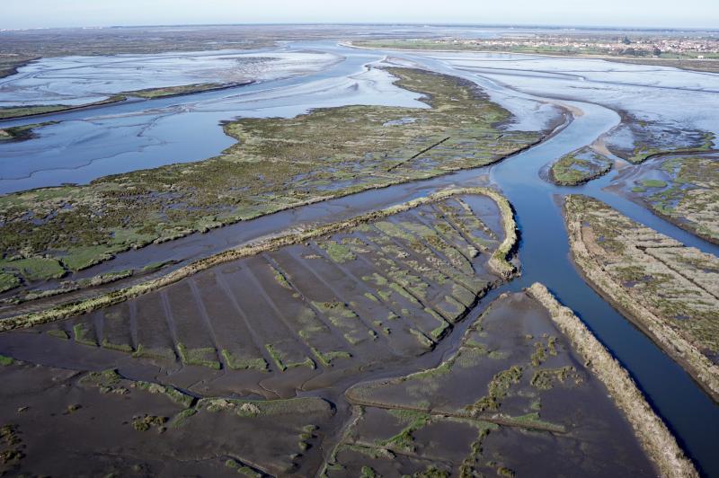
Ria Aviero ecosystem image credit: CESAM

The extensive lagoon and dune ecosystem of the Ria de Aviero, as this estuarial stage of the Vouga is known, now enjoys international status as a major bird sanctuary, home to some 20,000 overwintering wildfowl, the most photogenic of which being pink flamingos.

Trips around the centre’s canal system are a must and the colourfully decorated flat bottomed barges – Molicheiros – that once carried seaweed, salt and general goods now carry human cargo on 45 – 60’ guided excursions.

Unsurprisingly, the last fishing lofts lining the canals have finally closed and are being developed into luxury waterside apartments.

Back on land we visited an Art Nouveau house, now a museum with fine decorative detail, one of many tasteful villas that reflect an early C20th era of increased wealth and pride amongst its leading merchants.

The other end of the Vouga could not be more different. Foreign tourists like us were in short supply here in the mountains, probably because of the limited visitor attractions to lure people up from the popular coastal strip and dangerously high summer temperatures. The Upper Beira  region suffered badly last September from wildfires, causing evacuations and widespread disruption, and we sensed a nervousness even now, lest they return.

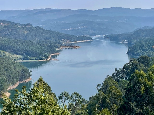
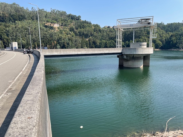
We stopped off at the Ribeirado dam and looked along the 14km long reservoir it created. It was built earlier this century to supply hydroelectric power, ease flooding and increase scarce water reserves. The road runs along the broad arc of the high dam wall, the power station and its infrastructure far below, where the river re-emerges. With the sheer valley walls either side the whole presents as a peerless study in concrete.

The brightest objects encountered in this uniformly grey spot were the red, blue and yellow recycling bins in the car park. Ominously, the control tower in the reservoir emitted flashing light and warning noises every few minutes. If this location were to feature in a future James Bond film or dystopian TV drama it would not surprise us. A perfect setting of its kind.

Another day we walked the middle reaches of the river. Was keen to access an upper trackway I’d clocked above the road while driving to our holiday accommodation nearby.

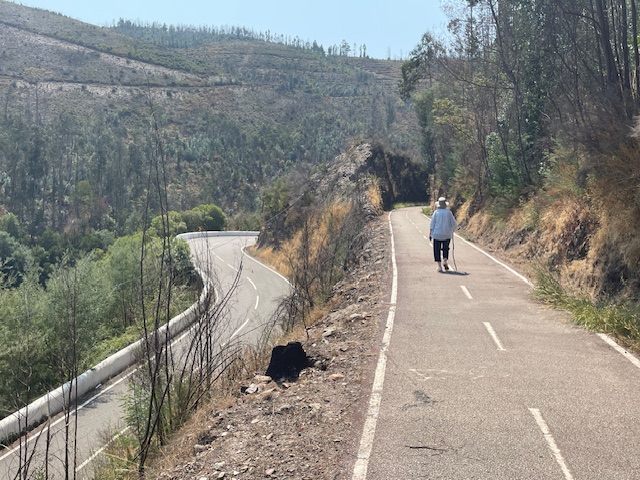
As suspected this was once a single track railway. Built just before WW1 it closed in 1980 and its repurposed state, the former Vale Das Voltas line offers superb viewpoints of the valley.

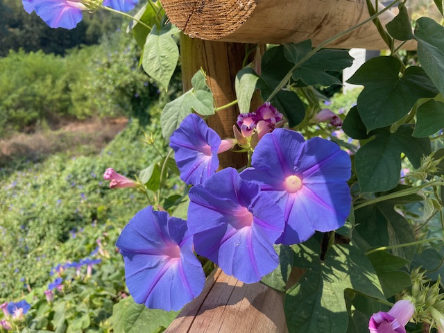
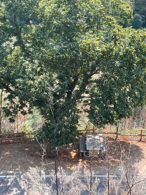
Our parking place by the road revealed a picnic table made from a single slab of local granite set under the awning of a mature horse chestnut tree. Masses of richly purpled convolvulus – bindweed – curled around the wood  rails.

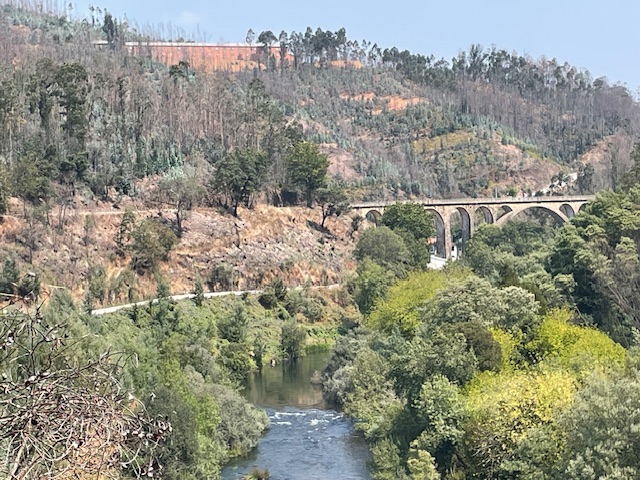
The track is understandably popular with cyclists, yet we only encountered four other pedestrians on our amble to and from the route’s spectacular highlight, the Santiago rail bridge at Pessegueiro do Vouga. It’s one of the highest stone masonry bridges in Portugal, with eleven arches and 165m high deck, gracefully spanning river and wooded slopes.

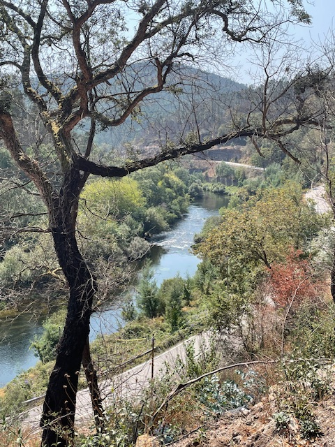
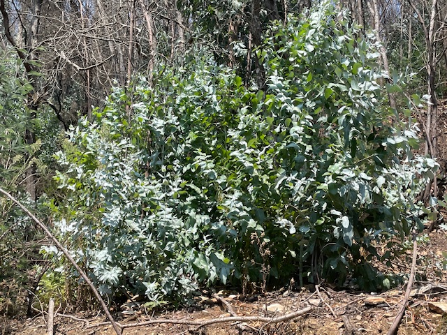
Our walk revealed a stark reminder of last year’s big burn. Blackened trunks and boughs in abundance. A contentious issue in these parts is the preponderance of silvery leaved eucalyptus trees, commercially planted to supply nearby works with biomass and extracted oils. That process is also understood to cause environmental air pollution.

This alien tree, of Australian origin, successfully sustains itself on steep slopes with minimum moisture and burns easily. Eucalyptus rapidly colonises cleared land post fire and is hard, if not impossible, to eradicate.

Our walk ended ‘off line’. Carefully crossing the white walled switchback of a highway, we descended to the quiet stillness of river bank and cooling shade of willow and alder that thrive here on its stony floodplain.

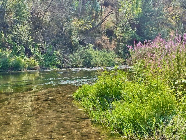
This middle stretch of the Vouga is officially designated a ‘Site of Community Interest’. That means minor blockages like weirs that present obstacles for migrating species of trout, eel, shad, barbel, lamprey or mullet are being gradually removed and in some places fish passes are being installed. Otters, birds of prey and many other species of birds and insects are also able to thrive here where human habitation is scarcer.

Delighted in encountering dragonflies and butterflies I waded barefoot in and allowed the hundreds of trout fry mingling in the sunlit shallows to continue feeding and flitting around my feet. A cooling calm end to our lovely lone amble under the afternoon sun.

Hanging Stones

When it comes to rest and recreation it pays to walk. The health and wellbeing benefits are obvious. It’s not so often though that you pay to walk. But that’s what we did a few weeks ago. And for a very good reason.

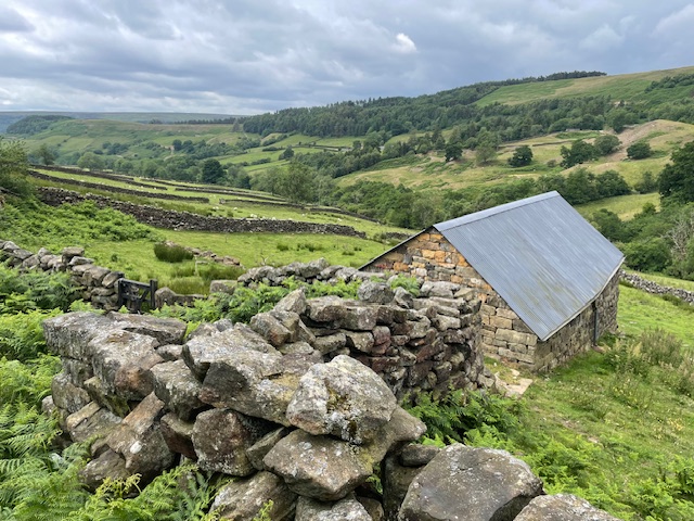
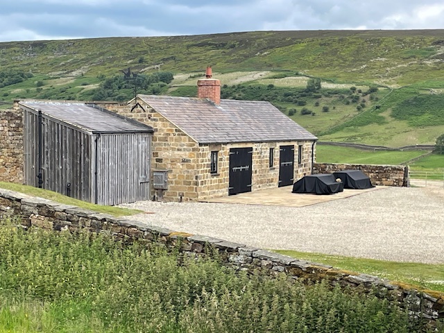
The Hanging Stones art project is unique. Ten restored or rebuilt former agricultural buildings, each containing a bespoke art installation, situated in the heart of the North Yorkshire Moors National Park, all linked by a 6 mile walk. It’s the creation of one of the UK’s – and indeed the world’s – leading sculptural landscape artists, Andy Goldsworthy. His long working relationship with stone dates back to time spent as a teenage farm labourer, maintaining and repairing dry stone walls in his native Yorkshire.

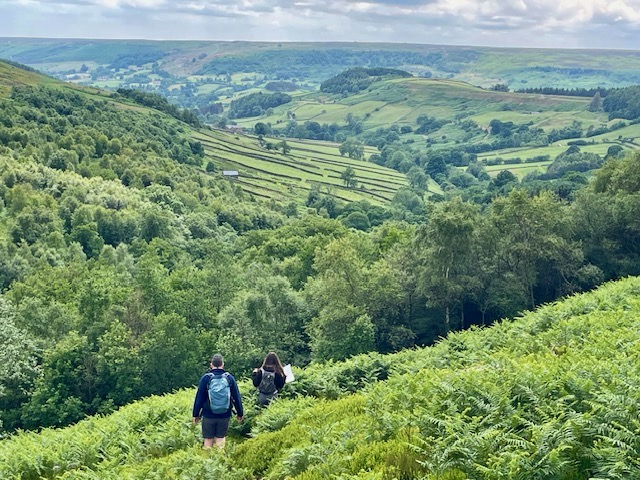
Our party of five was one of four groups of no more than six members booked each day. The trail begins and ends in the village of Rosedale Abbey. Parties set out every two hours along public paths, tracks and bridleways into the increasingly steep sided valley that is Northdale, defined on both sides by high bare moorland. At the highest point we saw the group ahead descending and those behind us ascending.

In his 2018 prospectus Goldsworthy wrote: ‘The walk is an integral part of Hanging Stones, the artery by which people will give life to the buildings….It will be both discreet and dramatic. Visible to those who know it is there and hidden to those that don’t’.

The Rosedale Abbey area has a long history of mining and quarrying although tourism, agriculture and field sports appear to provide most employment income these days. The highest part of our walk was on a permissive path that threaded through the source waters of the north beck, on whose steep bracken and heather clad slopes stand a dozen or more shooting butts. Returning along the lower valley floor we skirted an immaculately kept shooting lodge, currently under wraps, awaiting the open season in August.

This project clearly could not have happened without the approval and financial backing of the area’s main landowner, the Rosedale Estate, a 4,000 acre commercial grouse moor. Most of the North York Moors is owned by the King as Duke of Lancaster but this particular holding belongs to Carphone Warehouse founder David Ross. His philanthropic foundation supports arts, educational and sports activities. http://www.davidrossfoundation.co.uk/

With the buy in of the local community, the foundation and the National Park Authority, Goldsworthy’s vision and consummate skill has harnessed all the necessary elements to produce an outstanding example of renewal within a protected upland landscape. Work started in 2019 after a struggle to accommodate the proposal to the strict planning laws governing national parks it was given permission to proceed. The result is emotionally charged and thought provoking in its playful linked exposition.

 Goldsworthy says: ‘One of the rationales for working with buildings is that sound, atmosphere and materials are amplified when experienced inside a confined space’ That sense of theatre, which also invokes the atmosphere of a shrine or chapel, is the hallmark of the most effective of the interiors. Dramatic use of natural light and intense application of materials or textures onto the building fabric is fantastic.

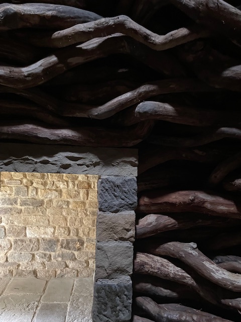
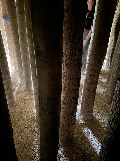
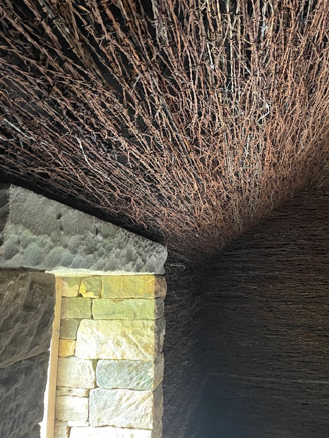
From weave of rusted barbed wire to powdered ochre paint, burnt boughs to woven logs or light bending thicket of poles in gravel – each environment works its rough magic, drawing you into a sensual response.

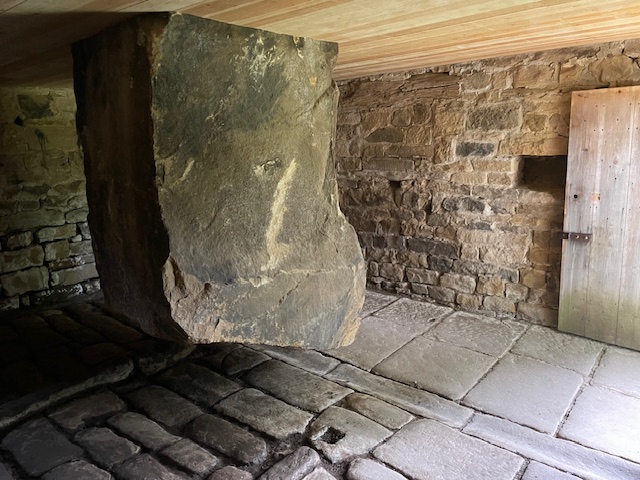
The barn that displays the eponymous hanging stone – all 11 tonnes of it – is brilliant testimonial to structural engineering that teases visual perception of mass in space.

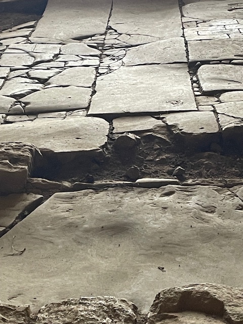
Elsewhere a new build barn traverses the ruin of an old farmhouse floor where the mosaic of concrete and broken flags yield clues of former occupation. This put me in mind of Thomas Hardy’s poem ‘The Self-Unseeing’ whose opening lines run: Here is the ancient floor / Footworn and hollowed and thin,/ Here was the former door/ Where the dead feet walked in.

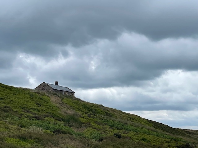
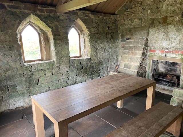
We enjoyed our packed lunches at the ramble’s half way point, following a steep upward scramble through swathes of bilberry covered moorland slopes. Here a large table sits in a little house perched on the open moor’s cusp. Through the open door on a clear day we enjoyed fine views across the high moorland plateau and cleave of dale spread out below.

Passing the shorn trunk of a wayside ash at one point I noted the cut section and wondered if this was an incidental wayside art work or just some essential tree surgery.

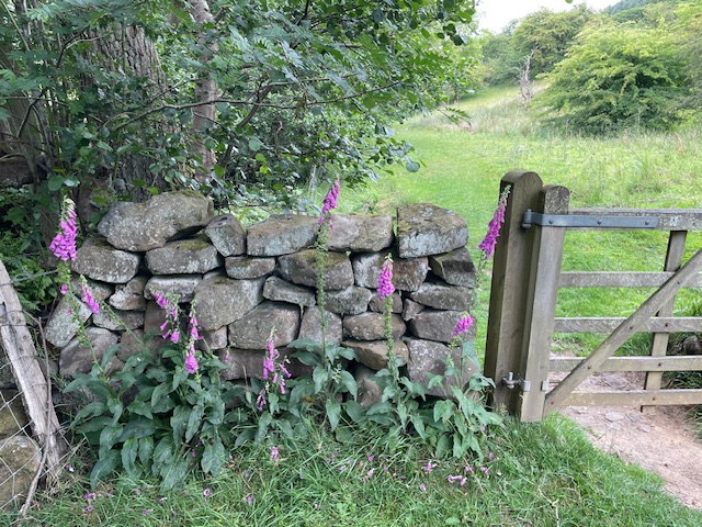
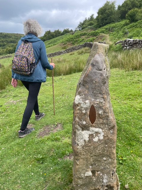
Goldsworthy’s attention to detail helps seal the overall impression. His way markers are subtle oval metal markers set into stone gateposts, some of which also feature small square through holes.

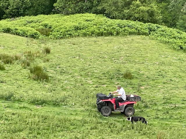
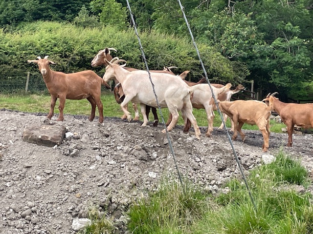
We spoke to a friendly farmer who asked if we were enjoying the art works. Later we saw him rounding up sheep with his collies astride a quad. I suspect he, like many here, are pleased to see redundant buildings restored and repurposed. Later, passing by another farm, we were presented with a picture book collection of ducks, geese, lambs, calves, dogs and goats, all putting up a cacophonous chorus of sound, much to our delight.

Cistercian nuns founded a priory in 1258 at Rosedale, establishing the wool trade which sustained them up to dissolution in 1539. In more recent times, from the 1850’s – 1920’s, high quality magnetic iron stone mining became the principal industry. On leaving we passed abandoned roasting kilns atop the valley’s precipitous Chimney Bank road, but with gradients of up to 33% it felt wise not to stop. 

I came away from this remarkable walk with a deeper understanding of how Goldsworthy and his collaborators created these amazing site specific art works, utilising natural local materials to complement and enhance a sensitive and highly protected rural environment.

It proved a memorable  immersive experience in which we as visitors are part of the synergy generated within each of those boxes of delight. Like all great art the effects are cumulative, resonating and lingering in the imagination long after actual contact.

The complex, often contradictory issues and compromises involved in the planning, funding and execution of this project has intrigued me almost as much as the actual installations themselves. I feel that’s worth a tenner of anyone’s money, to allow one the chance to walk in wonder, to witness and reflect on a particular genius of place and time.

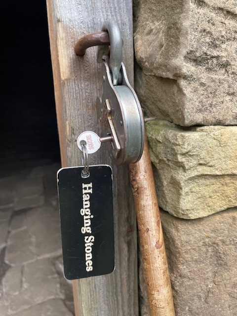
If you are able to experience Hanging Stones for yourself I’d urge you do so. Along with a set time on the allotted day you get a map and key that unlocks each building. Moderate map reading skills and stamina are needed, depending on seasonal weather conditions. Demand is high though. We hear that there’s no availability until February 2026.

More information and to book: https://hangingstones.org/

Clennell Wood Walk

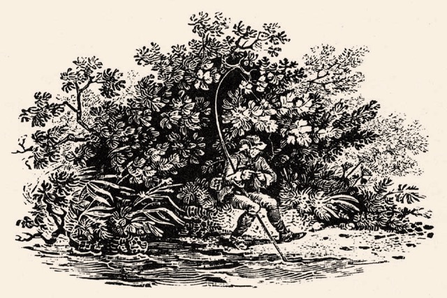
Shooting the Bird woodcut by Luke Clennell

I’ve been a member of the Bewick Society  (http://www.bewicksociety.org/) since I was first associated with Cherryburn, the artist and naturalist’s birthplace in the Tyne valley, and I’ve written about it here in the past. Recently I was amongst a small group of members who went on a walk from Tritlington, just north of Morpeth, to discover more about one of Bewick’s most accomplished apprentices, Luke Clennell, and the semi-ancient woodland there that today bears his name.

Our genial host was Michael Hunter, a Newcastle based landscape gardener, who during lockdown in 2020 bought three acres, a quarter of Clennell’s wood (formerly known as Robin Hood wood). With his Patterdale terrier Roo on a long lead (when not cradled in in his arms) Michael filled us in on the remarkable history of this rolling landscape between the A1 to the west and the Northumbrian coast a few miles east.

Born the son of tenant farmers in the nearby village of Ulgham Luke Clennell (1781-1840) was one of Thomas Bewick’s most promising pupils. with a similar rural background to his master. Young Luke was apprenticed to an uncle, a grocer in Morpeth, but so all consuming was his appetite and aptitude for drawing that the uncle and local patrons persuaded Bewick to take the 16 year old on in his Newcastle workshop. Clennel quickly became his master’s principal assistant, helping produce the hugely influential second edition of A History of British Birds and was responsible for some of its distinctive ‘tale pieces,’ small woodcuts wittily reflecting rural life, that tail ended the book’s sections.

The Angler is just one example of his skill and showcases Clennell’s particular ability in handling foliage. When his apprenticeship ended the young man left to set up on his own in London where he fulfilled his ambition to be a painter. Initially successful Clennell took on a massive commission in 1814 from his patron, the earl of Bridgewater, to commemorate a dinner of worthies at a post Napoleonic war conference that proved to be his undoing. In struggling to complete 400 separate sittings, sketching heads of attendees, the artist’s mental health, already strained by the death of his wife, collapsed and the painting was completed by another artist. Luke returned to his homeland and the care of family but never properly recovered, spending the last nine years of his life in the Newcastle asylum.

It’s hard now, overlooking this unremarkable stretch of rolling farmland to envisage the stark industrial landscape it presented to the world between 1990 and 2005. Then the wood we were visiting was an isolated island – saved from destruction by its official status as an ancient semi-natural woodland – marooned in a vast strip mining operation.The Stobswood open cast mine was operational1990 – 2007. During that time British Coal abstracted 13 million tons of coal and 250,000 tons of fireclay from the 580 hectare (1,433 acre) site. Appropriately the site known as the biggest hole in Europe had at its operational heart the biggest digger in Europe ‘The Ace of Spades’. This massive walking dragline was better known to locals as ‘Big Geordie’ and dominated the skyline for miles around.

Today that abyss has been completely filled in and restored as agricultural land, wetland, meadows and new woodlands. We could see on our approach along the public footpath that the woodland extension is currently dominated by colonising birch which will eventually give way to native species like oak, rowan and willow.It was a strange sensation walking over that swathe of restored land as the earth was spongy underfoot, not yet having properly settled, a process which will take years. It has been seeded with a wild flower mix so might be interesting to see how that fares as time passes. It was also a different consistency to the heavy clay of the unaffected land we passed, where bullocks grazed in old grass meadows by the infant riverside and its bank stabilising alders and willows.

Michael shares the 12 acre wood with three other buyers, their boundaries marked by coloured wooden posts. One focuses on shooting with a mini-range; another is given over to ornithology with many bird boxes and avian friendly settings while the third is an exemplar of wood craft, with renewed coppicing , dead hedging and other examples of traditional woodland management.

Michael and his family revel in their visits to the site and he’s allowed by regulation to camp out for a set number of nights a year. In that time he’s become (literally) a lot closer to nature, as an unobtrusive witness to the secret lives of its animal inhabitants, in particular hares, badgers, roe deer and foxes.

We visited the well established badger setts and traced their trods through the undergrowth of bluebells, wild garlic, dogs mercury and grasses. Stopping for a brew under the dappled canopy he pointed out the shallow depressions where deer have lain, the places where hares congregated to frolic of an evening.

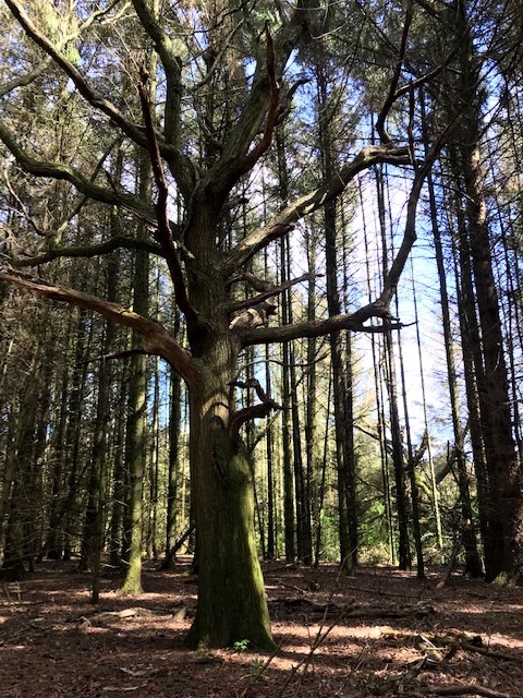
At some point in the 20th century the three quarters of acre at the wood’s heart had been cleared of broadleaf and replanted with spruce for commercial purposes. That sits awkwardly with the rest of the site, and we hoped it might be cleared and restored one day. Hauntingly, in amongst the dark looming pole straight conifers stood an old oak tree, a sole survivor from the past, seemingly dead but on closer examination still hanging on in there, with leaves emerging in its highest canopy to greet the hint of spring sun..

Having immersed ourselves for a happy couple of hours in this impressive survivor of semi-ancient woodland we left with a renewed faith in the ability of nature to recover from the severest sieges. Cheered too at the stewardship of individuals like our host whose actions help restore the balance of life, living in  harmony with and learning from the natural world. As we walked back over the brow of the hill I couldn’t help but feel that the essence of Luke Clennell’s troubled genius is resident in the wood he would have known as a boy, at home in a place where his artistic spirit can rest at peace.