Bountiful Berwickshire

We’re recently back from a celebratory weekend away, organised in secret as a gift to share with the significant other. Found a place near enough to drive to easily but far enough away to make for a proper countryside adventure. Some highlights then, as follows.

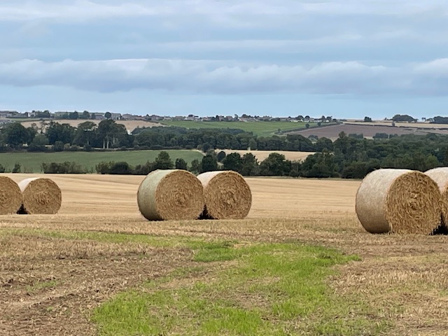
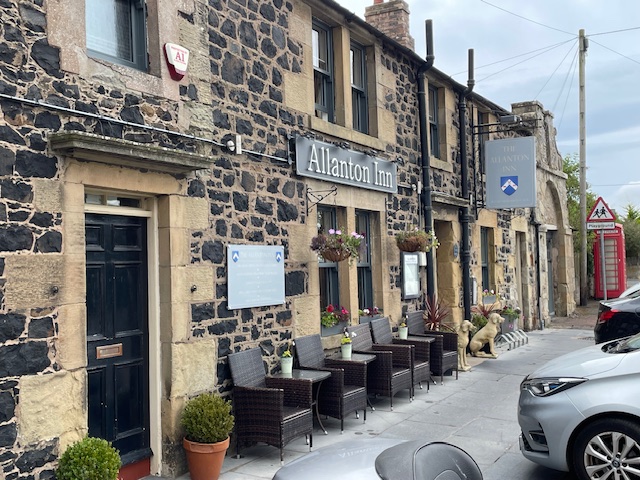
We arrived in Berwickshire, in the wide valley of the River Tweed and its tributary the Whiteadder, for our stay in the village pub at Allanton. All around the area huge combines, tractors and trailers were cutting, winnowing, baling and carrying off barley and specialist wheat. They continued late into the night, headlights glowing, growling over wide rolling fields with the lanes alive to traffic up to midnight. A fascinating contrast for us who live in the grassy uplands of west Northumberland where log lorries and tipper trucks loaded with gravel for forest roads are the big beasts of rural transport.

We sat out in the pub’s pleasant back garden with a refreshing pint before supper gazing over a scene of blond stubble and waving grain, shadows stretching to far woodlands, the land glowing warm under a setting sun. The Allanton Inn really is at the heart of its rural community. A family run business, part of an ecosystem of small independent local producers and suppliers, proud of their good food offer – from honey and ice cream to meat and eggs – as we were to partake of it. The perfect relaxed hostelry from which to explore this side of the border.

This is a land of big estates and large farms, the metal and concrete barns mostly modern and huge enough to properly house mountains of grain and straw. The population is much sparser now than it would have been in the pre-machine agrarian age. It’s extraordinary to note that within the radius of a couple of miles some of the great figures of the Scots enlightenment were born and grew up. These include the moral philosopher David Hume, geologist James Hutton and botanist and populariser of the tea plant, Robert Fortune.

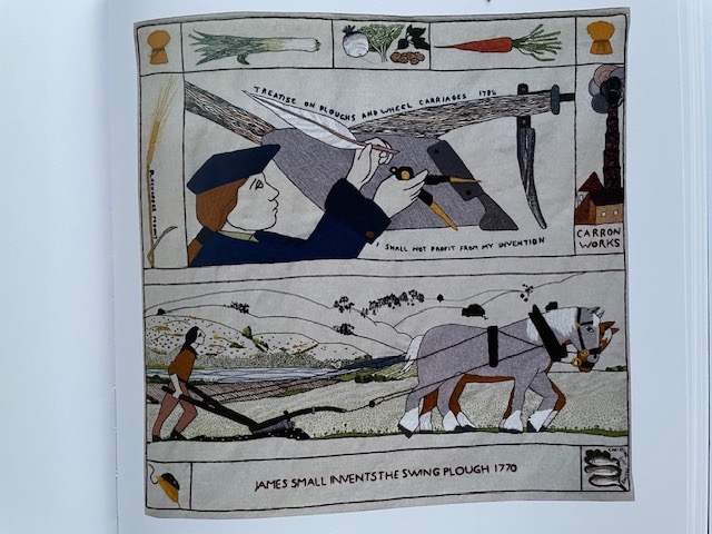
Most touchingly of all is the story of the least known of these worthies and the revolutionary device he freely gifted to agriculture, one that would help fashion the arable landscape around us today. In the 1770’s local engineer James Small used a smithy on the  former Blackadder estate at Allanton, using mathematics to experiment on different mouldboards, curvatures and patterns to produce his improvement on the ‘Rotherham’ cast iron swing plough. Previously many men were needed to work teams of oxen to pull a flat wooden plough while Small’s only required a pair of shire horses and a single ploughman to operate. Small even demonstrated his invention to ‘Farmer’ George III and his ‘Scots Plough’ was rapidly copied and developed by others as he not wish to profit from his invention by taking out a patent and sadly died in 1793 of overwork and poverty. Modern day embroiders have honoured his memory as James and the plough feature as one of the wonderful metre square panels in the Great Tapestry of Scotland, on permanent display in Galashiels.

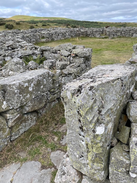
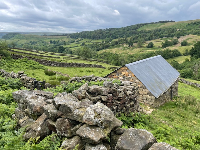
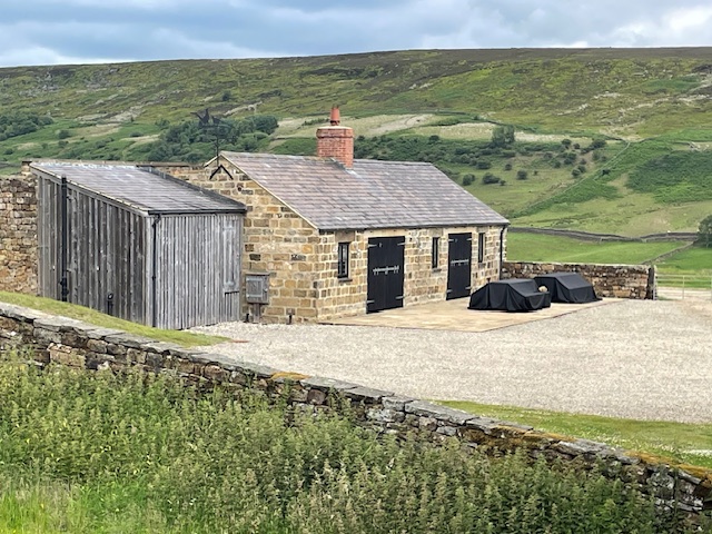
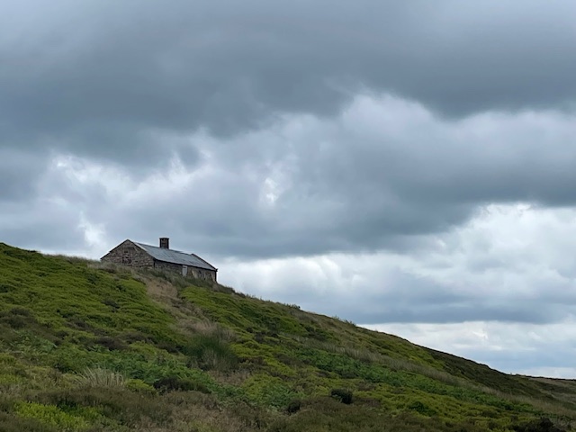
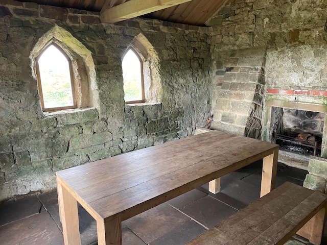
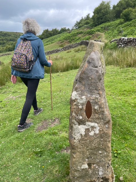
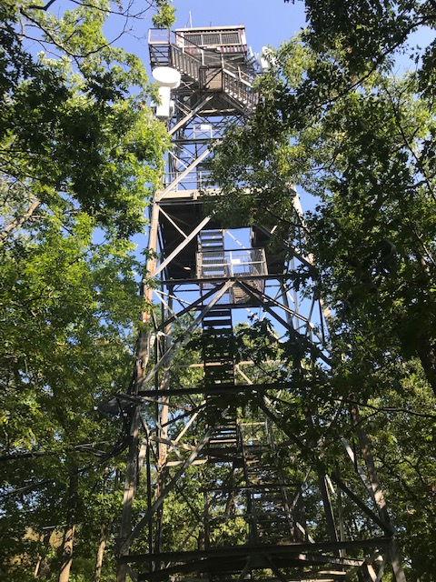
Situated on the eastern edges of the Lammermuir hills, below the lofty summit of Cockburn Law and overlooking a steep valley sits Edin’s Hall Broch. It was the high point of a circular five mile walk we took over fields, through woods, along tracks and heathland paths.

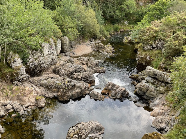
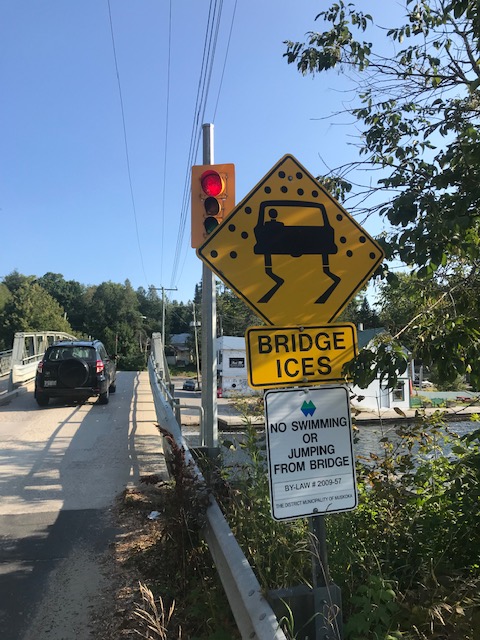
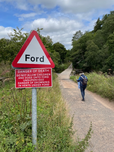
We made two separate crossings of the infant River Whiteadder by ford and footbridge. Summer picturesque as the scene was, one could imagine the place when the waters were in spate. The road sign at Abbey St Bathans reminds drivers of the risks.

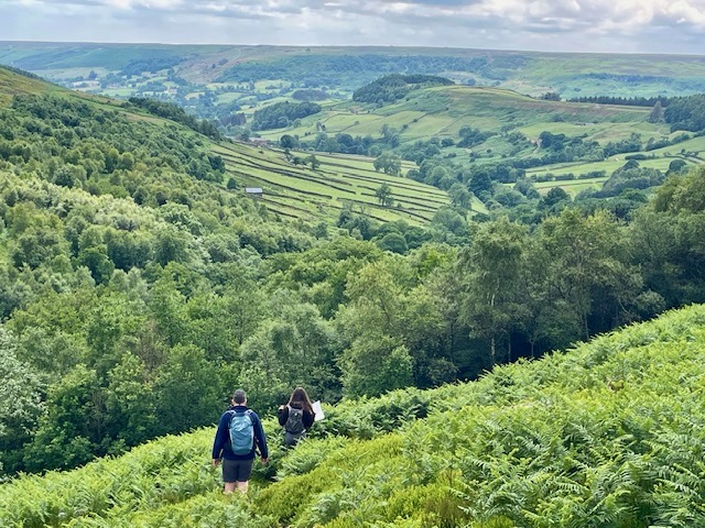
Brochs – ancient fortified tower houses – are usually found in the highlands and far north of Scotland so the one here is something of a geographical oddity. Our slow climb to reach it enhanced by seeing male wall brown and small copper butterflies basking in the sun and fluttering ahead as we climbed through swathes of tall bracken.

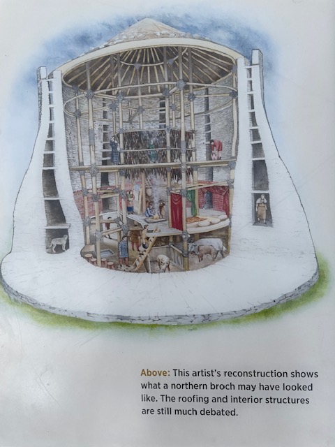
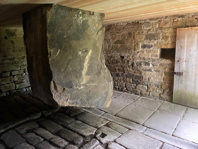
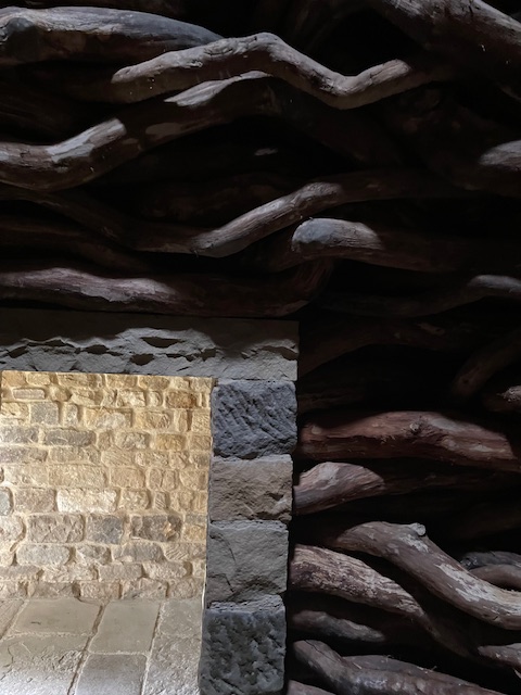
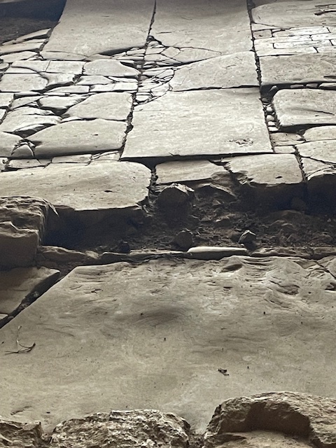
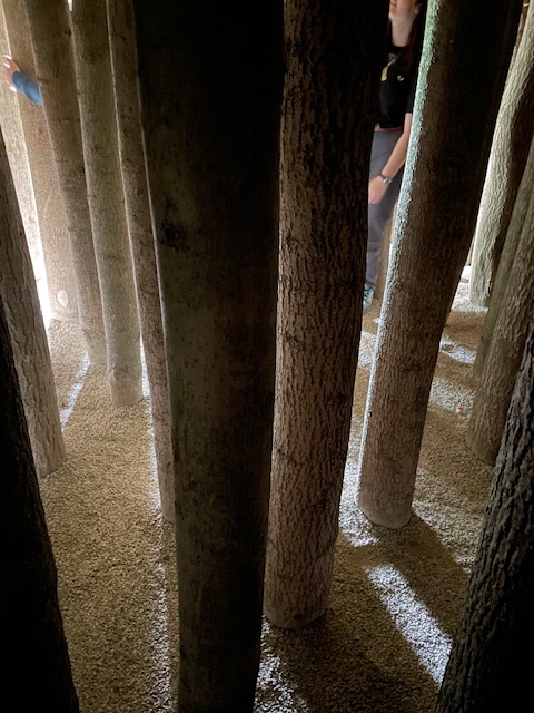
Dated to the 1st century AD what really lends Edin’s Hall broch a sense of wonder is that so much stone remains to define its walls, wide enough to incorporate chambers and stairs. The centre point gives a 360 degree experience of what was once a whole community’s secure home and stores, standing at least two levels high and probably roofed with timber. Hard by  the broch are remains of later hut circles, ditches and ramparts. Awed as we were we couldn’t help wondering though where its inhabitants would have sourced their water supply, with not a spring in sight.

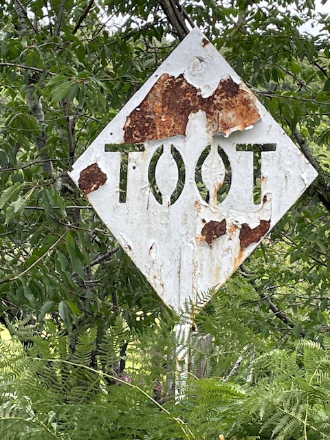
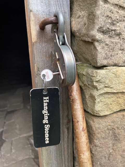
Picking up a metalled lane diving down into the wooded valley bottom we came upon this weathered sign at a hairpin bend. The only thing near a toot we heard on the descent was from the occasional whirr of spokes or tinkling bells as racing cyclists shot by with friendly waves. Like them we appreciated a rest break at the friendly informal tearooms in the old stables of the original village woodyard by the river. We can testify that the home baked fruit scones are superb.

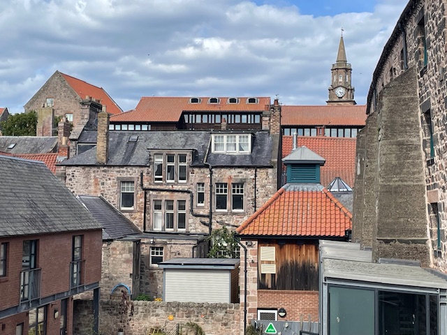
Every few years sees us on a return visit to Berwick. A preamble along the massive Elizabethan ramparts leads literally ‘off the wall’ into the multi-storied Granary gallery, a former Georgian warehouse on the quay overlooking the three great bridges, monuments of different centuries, that carry road and rail links across the great border river.

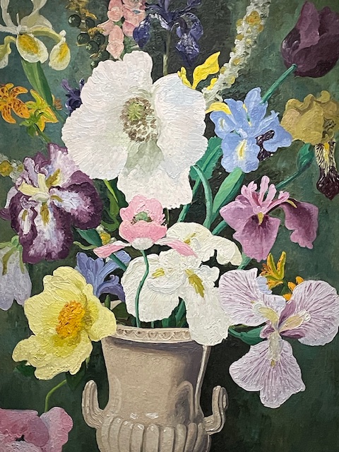
The retrospective exhibition we’d come to see at the Granary was of the respected artist, teacher and plantsman Cedric Morris (1889-1982). We found it something of a mixed bag. His flower painting, especially of Irises, remain glorious testimony to his knowledge and ecological awareness. The best known self-portrait and studies of Parisian café life in the 1920’s insightful and sensual. 

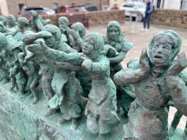
The art that really moved us though was on the seafront across the border at Eyemouth. In October of 1881 a terrible storm wreaked havoc on the Berwickshire coast, and 189  local fishermen were drowned, leaving behind 78 widows and 182 children. The town’s fortunes went into long term decline in the wake of this, Scotland worst recorded fishing disaster.

‘Widows and Bairns’ represents real people, arranged in groups above the name of their boats. Sculpted by Jill Watson and cast by Powderhall Bronze it opened in 2016. We watched visiting families stop and talk about the story. The best kind of public art, rooted in people’s history, powered in this instance by tragic drama to command our attention and stimulate conversation.

In the 21st century, the community here has been embracing eco based industries and sustainable tourism and this attractive harbourside town – like Berwick across the border – seems on the cusp of change for the better. The broader Eyemouth story is well told in the delightful volunteer run museum housed in a former church.

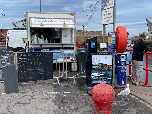
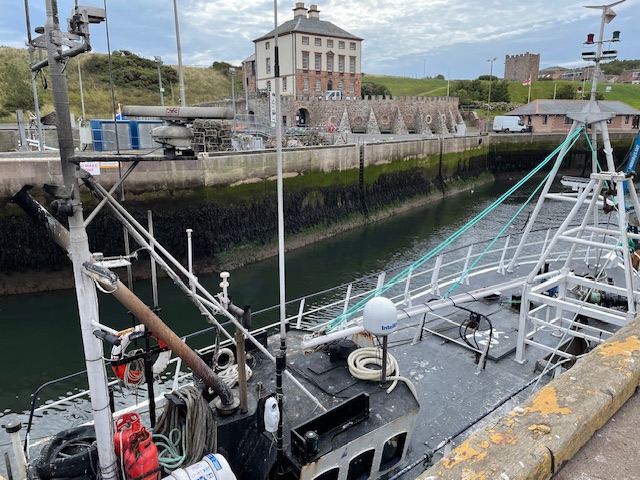
We also enjoyed taking a leisurely stroll along the narrow harbour around the mouth of the river Eye with its working fishing boats, quayside  processing plants and local produce stalls. (kipper rolls anyone?) These merge with an array of smart locally based retail businesses (excellent Italian ice creams), the sandy town beach and restored stone jetty with its bright red handrails and fine prospect.

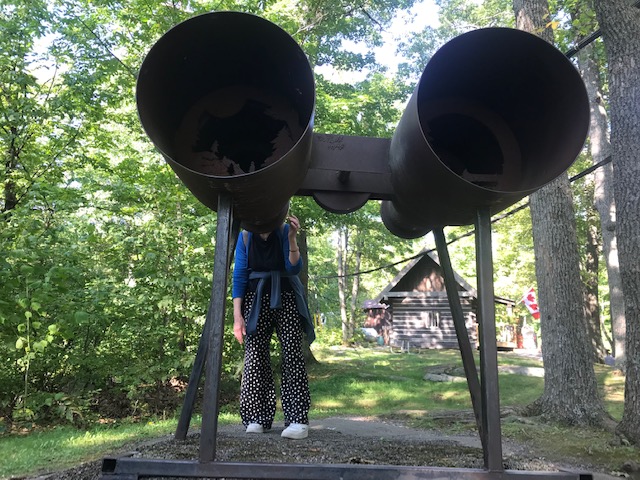
A little further up the rocky coast lies St Abb’s Head, named for a Northumbrian princess who founded a monastery here, now long lost, following her safe delivery from shipwreck. Fittingly a lighthouse, dating from the 1860’s and built by the Stevenson family (who else?), still casts its powerful light from the head. Unusually, it is tucked into the cliff below the lighthouse keepers cottages (now holiday accommodation) as the higher ground above and beyond has always been prone to mist and rain, obscuring vision at sea. Hence the red painted fog horn, seen below.

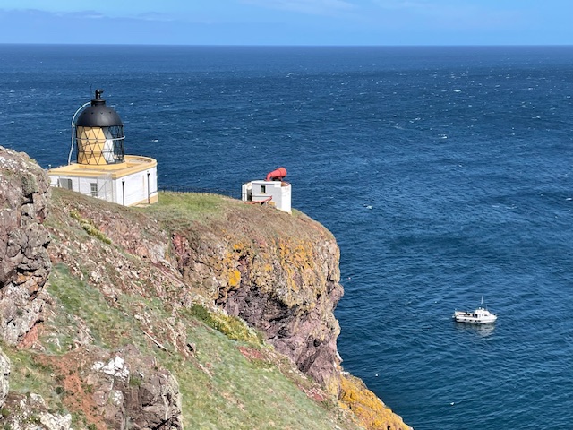
If we’d been here in late Spring we’d have witnessed the vast flocks of gannets, razorbills, gannets, kittiwakes and other seabirds that crowd the nursery rockfaces and for which the bird reserve is nationally renowned. Their guano, whitening the masses of red blue sandstone rocks, is striking but the birds and their fledglings were no longer in evidence this bright breezy morning in August. Instead masses of house martins dominated the clear blue skies above small bobbing boats filled with visitors tasking in the awesome sea level view of this spectacular headland.

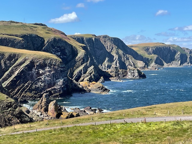
Our return leg, mostly along the single track lighthouse access road, revealed a stunning surprise vista of more cliffs running northwards. Once out of the severe wind tunnel blast between those cliffs and St Abb’s head, the path drew us away into the calm serenity of a narrow fresh water loch in a ravine fringed with reed and sheltered by woods. The National Trust for Scotland run the excellent visitor centre in an old farm complex where we parked to start and finish our wonderfully rewarding  four mile trek.

Recently shorn cheviot sheep at St Abb’s head

Hanging Stones

When it comes to rest and recreation it pays to walk. The health and wellbeing benefits are obvious. It’s not so often though that you pay to walk. But that’s what we did a few weeks ago. And for a very good reason.

The Hanging Stones art project is unique. Ten restored or rebuilt former agricultural buildings, each containing a bespoke art installation, situated in the heart of the North Yorkshire Moors National Park, all linked by a 6 mile walk. It’s the creation of one of the UK’s – and indeed the world’s – leading sculptural landscape artists, Andy Goldsworthy. His long working relationship with stone dates back to time spent as a teenage farm labourer, maintaining and repairing dry stone walls in his native Yorkshire.

Our party of five was one of four groups of no more than six members booked each day. The trail begins and ends in the village of Roseland Abbey. Parties set out every two hours along public paths, tracks and bridleways into the increasingly steep sided valley that is Northdale, defined on both sides by high bare moorland. At the highest point we saw the group ahead descending and those behind us ascending.

In his 2018 prospectus Goldsworthy wrote: ‘The walk is an integral part of Hanging Stones, the artery by which people will give life to the buildings….It will be both discreet and dramatic. Visible to those who know it is there and hidden to those that don’t’.

The Roseland Abbey area has a long history of mining and quarrying although tourism, agriculture and field sports appear to provide most employment income these days. The highest part of our walk was on a permissive path that threaded through the source waters of the north beck, on whose steep bracken and heather clad slopes stand a dozen or more shooting butts. Returning along the lower valley floor we skirted an immaculately kept shooting lodge, currently under wraps, awaiting the open season in August.

This project clearly could not have happened without the approval and financial backing of the area’s main landowner, the Rosedale Estate, a 4,000 acre commercial grouse moor. Most of the North York Moors is owned by the King as Duke of Lancaster but this particular holding belongs to Carphone Warehouse founder David Ross. His philanthropic foundation supports arts, educational and sports activities. http://www.davidrossfoundation.co.uk/

With the buy in of the local community, the foundation and the National Park Authority, Goldsworthy’s vision and consummate skill has harnessed all the necessary elements to produce an outstanding example of renewal within a protected upland landscape. Work started in 2019 after a struggle to accommodate the proposal to the strict planning laws governing national parks it was given permission to proceed. The result is emotionally charged and thought provoking in its playful linked exposition.

 Goldsworthy says: ‘One of the rationales for working with buildings is that sound, atmosphere and materials are amplified when experienced inside a confined space’ That sense of theatre, which also invokes the atmosphere of a shrine or chapel, is the hallmark of the most effective of the interiors. Dramatic use of natural light and intense application of materials or textures onto the building fabric is fantastic.

From weave of rusted barbed wire to powdered ochre paint, burnt boughs to woven logs or light bending thicket of poles in gravel – each environment works its rough magic, drawing you into a sensual response.

The barn that displays the eponymous hanging stone – all 11 tonnes of it – is brilliant testimonial to structural engineering that teases visual perception of mass in space.

Elsewhere a new build barn traverses the ruin of an old farmhouse floor where the mosaic of concrete and broken flags yield clues of former occupation. This put me in mind of Thomas Hardy’s poem ‘The Self-Unseeing’ whose opening lines run: Here is the ancient floor / Footworn and hollowed and thin,/ Here was the former door/ Where the dead feet walked in.

We enjoyed our packed lunches at the ramble’s half way point, following a steep upward scramble through swathes of bilberry covered moorland slopes. Here a large table sits in a little house perched on the open moor’s cusp. Through the open door on a clear day we enjoyed fine views across the high moorland plateau and cleave of dale spread out below.

Passing the shorn trunk of a wayside ash at one point I noted the cut section and wondered if this was an incidental wayside art work or just some essential tree surgery.

Goldsworthy’s attention to detail helps seal the overall impression. His way markers are subtle oval metal markers set into stone gateposts, some of which also feature small square through holes.

We spoke to a friendly farmer who asked if we were enjoying the art works. Later we saw him rounding up sheep with his collies astride a quad. I suspect he, like many here, are pleased to see redundant buildings restored and repurposed. Later, passing by another farm, we were presented with a picture book collection of ducks, geese, lambs, calves, dogs and goats, all putting up a cacophonous chorus of sound, much to our delight.

Cistercian nuns founded a priory in 1258 at Roseland, establishing the wool trade which sustained them up to dissolution in 1539. In more recent times, from the 1850’s – 1920’s, high quality magnetic iron stone mining became the principal industry. On leaving we passed abandoned roasting kilns atop the valley’s precipitous Chimney Bank road, but with gradients of up to 33% it felt wise not to stop. 

I came away from this remarkable walk with a deeper understanding of how Goldsworthy and his collaborators created these amazing site specific art works, utilising natural local materials to complement and enhance a sensitive and highly protected rural environment.

It proved a memorable  immersive experience in which we as visitors are part of the synergy generated within each of those boxes of delight. Like all great art the effects are cumulative, resonating and lingering in the imagination long after actual contact.

The complex, often contradictory issues and compromises involved in the planning, funding and execution of this project has intrigued me almost as much as the actual installations themselves. I feel that’s worth a tenner of anyone’s money, to allow one the chance to walk in wonder, to witness and reflect on a particular genius of place and time.

If you are able to experience Hanging Stones for yourself I’d urge you do so. Along with a set time on the allotted day you get a map and key that unlocks each building. Moderate map reading skills and stamina are needed, depending on seasonal weather conditions. Demand is high though. We hear that there’s no availability until February 2026.

More information and to book: https://hangingstones.org/

Fire and Ice

I can see all the country from Bolkow to Sheahan / And watch Lou go back in his flying machine/ Oh well its a job and I really feel great/ When reporting the ‘smokes’ Lou can’t see from his crate. From ‘A Towerman’s Lament’ by L Moreau

Dorset was another interesting historic lakeside spot to visit. Like Bobcaygeon it occupies a neck of flat land between lakes where once First Nations peoples lived and traded sustainably.

The settlement’s preserved centre boasts a canal side museum in the old schoolhouse, white clapboard church, craft shops, restaurants, a former lake pleasure steamer and a much loved well patronised traditional general store (est. 1921) full of essential items on different floors needed to sustain the scattered rural communities hereabouts.

The bridge over the canal is a sturdy steel arched affair with lights to regulate traffic and warning signs of icy winter dangers. Dorset’s most famous engineering feature though is its preserved fire tower on the heights above the town.  A network of open sided metal watch towers, some 140 metres high were erected in the 1920’s, manned by fire wardens (Tower Jacks) from May to October to monitor the hundreds of square miles of forests for conflagrations. Use of spotter aeroplanes in the 1960’s made the towers redundant and they in turn were superseded by satellite cameras in the 1980’s.

This sole remaining tower on the Dorset heights is actually the second on site and of a different design, as it was originally intended to be an early warning structure on a military base during the cold war era.  Rescued and re-sited by a local community body it now doubles as telecoms tower and popular tourist attraction.

It’s easier to ascend the open structure’s 128 steps, eyes upwards, than to descend, which is more vertiginous and harder on the leg muscles. Apparently only 6 visitors in 10 feel able to make it to the top viewing platform. (It’s caged in to prevent anyone doing anything they shouldn’t). We met fellow Brits on the way who lived in Dorset and who just had to include it in their to do list.

The views from the top are truly spectacular and gives a real feel for the distinctive landscape of forest and lakes stretching away to far horizons so I for one was glad I’d overcome a fear of heights to be rewarded with such an awesome 360 degree vista.

A giant metal sculpture at the base of the tower attracts visitors who may have left their own binoculars behind!