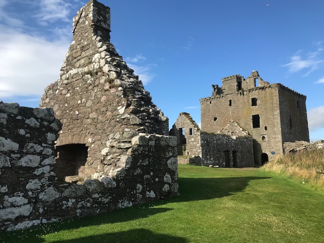
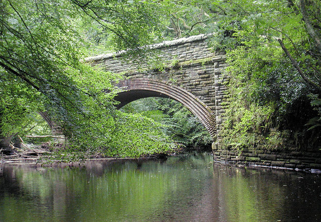
From the Dee to Dunnottar Castle. Billed as one of Scotland’s major tourist attractions, we joined hundreds of other visitors – most of them from European countries – to take in the stunning view of the great ruined fortress sitting some 160’ above the north sea on a spur of land made up of boulders cemented in igneous rock millions of years old. Once an early Christian chapel it had previously been a fortress – Dun being Pictish for ‘place of strength’.
Dunnottar’s deliberate pinch point of an entrance, half way up the great rock, is little wider than a domestic doorway with narrow cobbled passage way and yet more stairs, opening out at last onto a grassed plateau with an impressive range of grey sandstone buildings, most of them now open to the elements; chapel, stables, smithy, great hall, bedrooms, barracks, great keep etc, many set over cellars, and vaults. Rocks and swirling waves are glimpsed below the sheer cliffs . How did the builders of this bastion ever manage to get so much material and supplies from mainland behind to headland in front?
For centuries Dunnottar was the principal stronghold of Scotland’s Earl Marischal, one of the great officers of state, inherited through many generations by the aristocratic Keith dynasty. In that time it hosted Mary Queen of Scots and Charles II and saw attacks and sieges in both the War of Independence and Civil War. The 10th Earl’s active support of the 1715 Jacobite rebellion lost the family their lands and titles and Dunnottar was subsequently stripped of all fittings and re-usable building material.
Purchase of the castle by Lord and Lady Cowdray two centuries later saw it stabilised, repaired and re-opened to the public. Their descendants still own and manage the site. Even with lots of us visitors milling about and some testing climbs the castle ticks the necessary boxes of romantic ruin, superb viewpoint, historical atmosphere, preserved range of habitations, royal associations, fighting and conflict, immersion in the elements. …What more can one ask for?
We walked the high cliff path the 1.5 miles to Stonehaven. The town’s interlinking harbours spread out before us before the steep path descent to test your leg muscles. Our destination, appetites sharpened and senses primed, was the area’s most recommended and multi-awarded eateries, there on the beach promenade – The Bay. We sat outside to eat our haddock and chips after queuing for more than half an hour. It was well worth the wait. As the line shuffled forward we learnt the fish was fresh caught with the local boat named alongside the variety and farm in Norfolk the potatoes came from. One veggie offer the display board listed was chick pea fritters and n’are a deep fried Mars Bar anywhere!
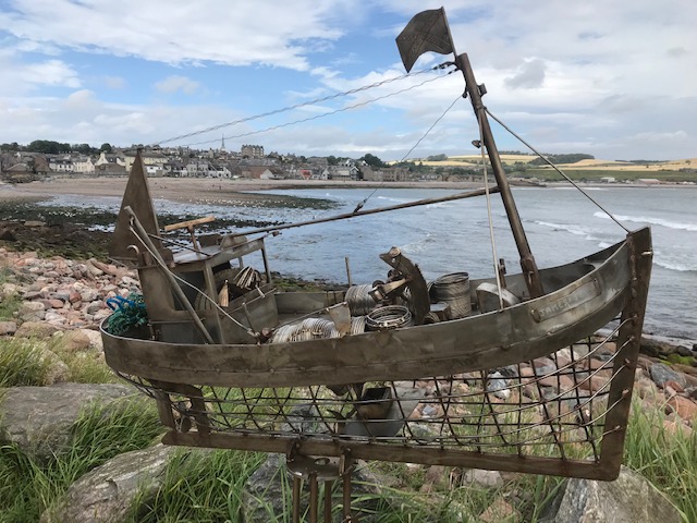
On the return leg we stopped in admiration of a series of art works aside the beach boardwalk fashioned by an anonymous ex-seafarer dubbed ‘Stonehaven’s Banksy’. His humorous skilfully fashioned boat sculptures made of scrap metal first appeared anonymously about the place in 2006. In 2019 he told the local paper that “I’m nae an artist, I’m just a guy that bashes metal together” and that “The sea to me means freedom”. We’ll drink to that!
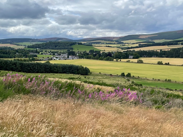
Arriving in Aberdeenshire the main road follows the stately River Dee downstream. We passed the huge car park that accommodates hordes of visitors for Balmoral, with police signs on the road prior saying ‘No stopping’. Our destination was one less called on, the village of Tarland, a few miles north of the main highway. The villagers have been enterprising in promoting sustainable green tourism by establishing a network of paths and trails through their district, although sadly we didn’t have enough time on this visit to explore them further.
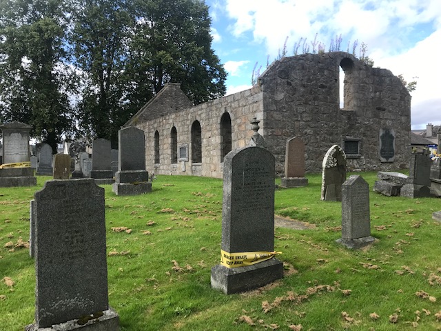
Our priority this initial visit, to explore the tree lined churchyard where the old abandoned Kirk stands, fronting the village square. Tarland was the rural settlement from where one of Kim’s forebears departed as a soldier in the Royal Engineers for Canada in the 1860’s, ending his career as the chief of police in Montreal.
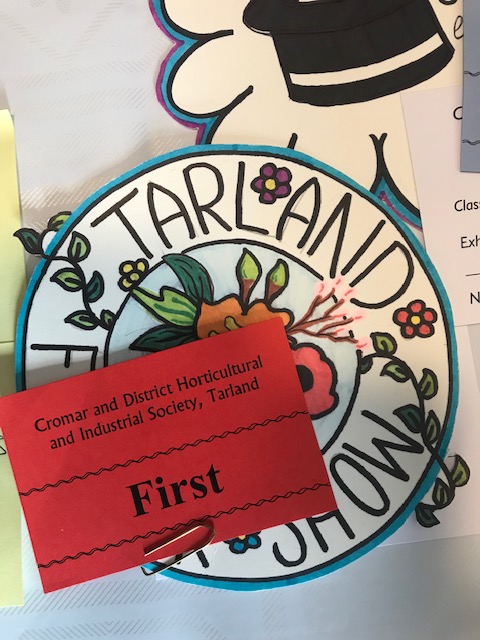
After a time scanning granite gravestones for family surnames we refreshed ourselves with tea and cakes in the café on the square. Then popped into the institute opposite to join the throng viewing an abundance of produce and prizes, courtesy of the local horticultural society at their annual show.
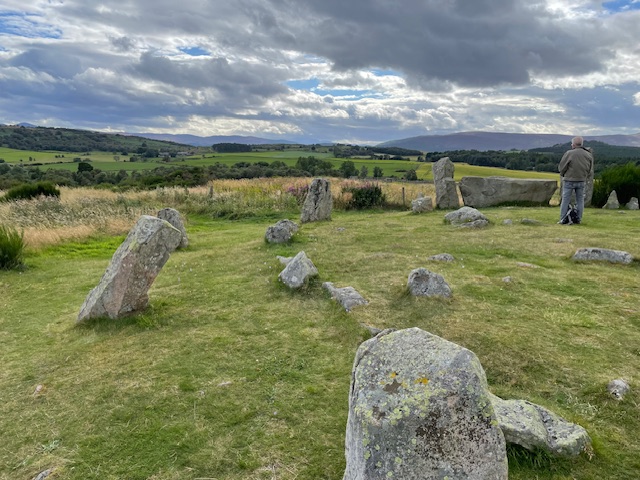
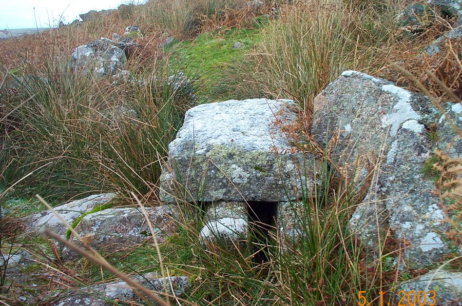
Leaving Tarland we stopped off on a gentle hill a couple miles distant to visit Tomnavirie Stone Circle on its fine view point of a summit. This atmospheric site dates from some 4,500 years ago. The key feature being that its biggest stone lies recumbent, flanked by tall uprights, framing a view of Lochnagar in the distant Cairngorms range. This circle’s inner kerb of stones once held a low cairn with a hollow centre. Amazingly, there are as many as 69 known structures like this, unique to north-east Scotland. The significance of all these features remain objects of speculation but were obviously of great existential meaning to the Bronze age farmers who constructed them.
The symbols of existence and survival in ancient times and in the 20th Century are juxtaposed here with a nice touch of irony, as an abandoned cold war bunker lies just a stone’s throw south west of the stone circle. Its stairway entrance is still visible and below ground local members of the Royal Observer Corps would have hunkered down in the fully equipped bunker in the event of nuclear warfare, only venturing out to take samples of fall out to send to CHQ. How that would have actually worked in practice is rather dubious to say the least.
‘Who can impress the forest, bid the tree/ Unfix his earth bound root?’ (MacBeth)
Apart from being based in Pitlochry Festival Theatre in the late 1970’s, rehearsing an extensive autumn long tour of schools in the highlands and Islands, I ‘ve never been to Perthshire. As it happens neither had Kim, so a few days staying with friends Robin and Linda in Aberfeldy, at the start of this August’s Scottish holiday was a treat.
Aberfeldy we discovered is a bustling small town of independent shops and businesses – including a community run cinema – proud to be Scotland’s first Fairtrade town. Robert Burns in 1787 wrote a poem about the Dens of Moness, the ancient wooded gorge high above the town. Inspired by its profusion of birch trees he called it ‘The Birks of Aberfeldie’ and today a statue of the bard sits in lonely splendour on the leafy banks of the fierce little river. His original pen having been nicked a twig suffices for replacement.
A lovely 1.5 mile circular steep sided walk immersed us in the narrow valley’s sylvan charm. Our friends went off the path at one point to gather chantarelles for a risotto supper but we demurred for fear of attracting tics. Sure enough, later Robin would be showing us how to remove and properly dispose of the three tiny bloodsuckers which had attached to his calf muscle in the course of foraging.
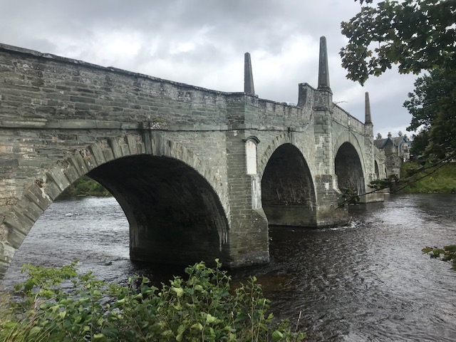
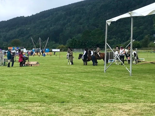
Next day was the first day of the annual Aberfeldy show. Dodging the traffic, we crossed the River Tay by General Wade’s elegant hump backed road bridge. It was designed by William Adam and opened in 1733, laying the foundation stone of the town’s subsequent growth as a rural centre. The show was delightful and I was unexpectedly charmed by the equestrian competitions’ assortment of riders and mounts; the little people dressed to the nines on their ponies, with adults leading, put one in mind of Thelwell’s classic cartoons.
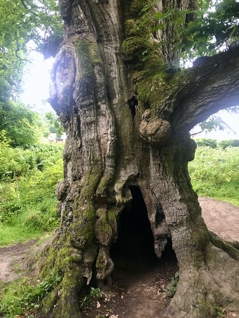
Friday night we drove to Birnam, at the heart of Perthshire ‘Big Tree’ country. Followed the Tay downriver through the remnants of the great deciduous forest that once clothed these hills, where now conifers predominate. Stopped to admire the 500 year old oak, a symbol of the wood that is famously associated with Shakespeare’s Macbeth. A troupe of travelling London actors was licensed to play in nearby Perth in 1589….Was the bard amongst their number? The lower trunk, which is hollow, was submerged by floods caused by Storm Desmond in 2015 and that weakened it. To avoid danger of splitting under its own weight supports have been added to lower boughs.
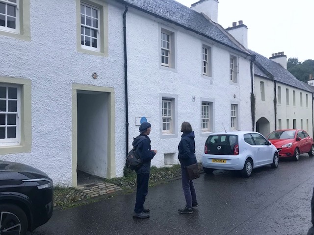
On to cross the broad river on a grand former toll bridge into historic Dunkeld, the elegant ancient borough framed by tree covered slopes. We discovered the pretty square and street leading to the gated ruins of the cathedral, both of which were saved from dereliction in the mid C20th. We were surprised to come across this link with Canadian history on the wall of one of the old terraced houses.
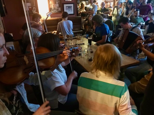
The bar of the Tayside Inn, a former grand temperance hotel, was already buzzing when we got there with an appreciative crowd come to hear a posse of young (and not so young) traditional musicians weaving their rough magic, infused and varied with jazz and rock influences. More instrumentalists turned up and we squeezed ourselves into the standing room only corner and cheered and clapped as they wooed us all with their ace instrumental skills.
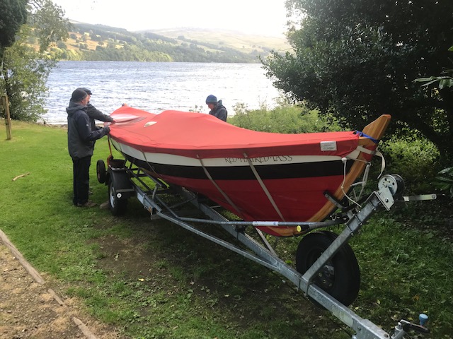
We took a trip up to the resort village of Kenmore on Loch Tay. Linda introduced us to her friend, the red haired lass – a skiff moored under canvas by the water. Linda and her club mates had painstakingly constructed it themselves from a template. Every modern racing boat has to be built to the same design, to ensure fair competition. The Loch Tay team is the only Scottish inland crew, the rest being coastal based. I’ve loved watching gig racing in the bays and estuaries of Cornwall and Pembrokeshire so would delight to see this form of rowing action on the open water too. Gig boats, we were told, are slimmer in the beam and have six oars at work while skiffs have four.
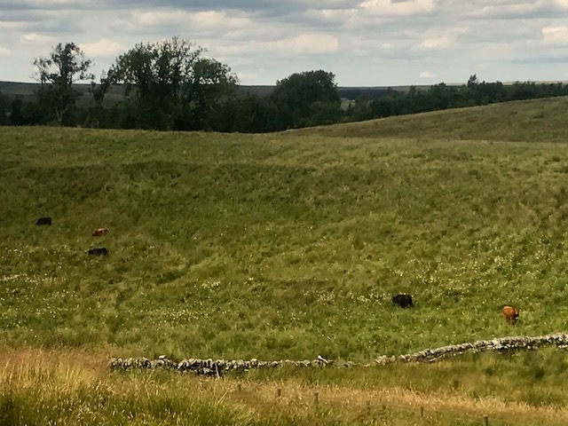
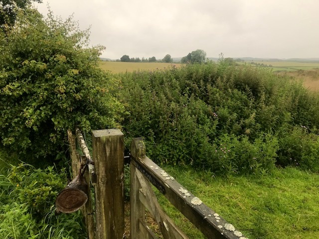
I recently learnt a wry lesson about the perils of attempting to quarter cattle in a field. Some weeks ago, over coffee in our kitchen, I suggested to our friend and neighbour up at Southridge farm that he put some cattle on the crags – our four acres of rough grazing. The stone walls have supplementary fencing topped with barb and the spring at the bottom could provide enough water for cattle.
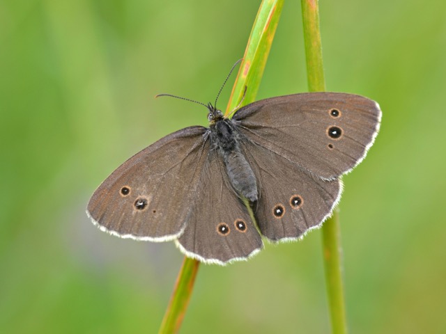
The family usually park their handful of Texel tups there after they’ve done servicing the ewes and they’re usually taken off for shearing and pastured elsewhere before returning in spring. It’s a good arrangement whereby our grass is grazed rested and kept serviceable and they get free pasturage. I thought a few cattle there, grazing it differently, might improve the quality of pasture. Subsequently walked the boundaries, wading through grass and rushes waist high in places. Ringlet butterflies flutter around me, dancing over dense patches of tormentil and bedstraw. Slipped a few loose capping stones back into place on the walls. All fences and walls reasonably secure.
Ringlet image by Andrew Cooper (Butterfly Conservation)
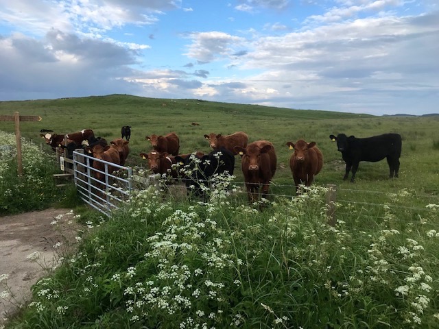
Some six years ago our neighbours invested in suckler beef cattle to partner their sheep operation. A new shed was built for winter housing and another borehole sunk to supplement stock water supply. They opted for Stabilisers. An odd name for a scientifically bred and patented animal conceived to fit modern market requirements. Originating from a specialist research centre in Nebraska in the 1970’s, a conglomeration of Yorkshire farmers brought the breed to the UK in 1997 and have done well out of it since as you see increasing numbers of them on British hill farms.
Stabilisers usually present in a range of colours from black through shades of brown to deep red reflecting the fact that they are a four way cross between traditional Hereford, Angus, Simmental and Gellbrich breeds, harnessing the best traits of each. Small and hardy, easy calvers, gentler temperaments and easy to handle with good growth rates. The lower cost, lower labour equation makes them attractive to farmers while the quality, marbled and tender meat has a guaranteed bulk buyer in Morrison supermarkets. On a more mundane level I found them attentive listeners when I talk to them, perched on the wooden style opposite, or watch them from a distance lick and nudge each other.
Our farmer turns up one weekend before last to say he’d just put a lame cow with her calf on the crags, so I was thrilled. Later I went out with the camera to record them in situ, only to find mother in our neighbour’s big pasture next door and her calf mooing inconsolably wandering the long grasses. Rang Southridge and our neighbour arrived on his quad to steer the reluctant mother back to our patch. Meanwhile – and this is the real mystery – the calf had somehow slipped between fence and dry stone wall into the other neighbours hillside field to join their separate herd of older stabiliser steers on the hillside belly high in swathes of meadowsweet, grasses and reeds!
Mother meanwhile evaded all efforts to get her back onto our side of the fence. She must have jumped over it to get to the big field. A metre high barrier is clearly not enough to deter a determined cow. Our good neighbours – father and son – eventually managed to retrieve both beasts from the different fields and drove them back up to the farm. We humans laughed it off in passing. Watching their retreating figures up the lane caused me to reflect with a rueful smile that I should have listened more and talked less to those curious bovines in the field. After all they know what herd instinct is and follow it to the letter. Fences can be jumped, walls walked around, company found and humans confounded.
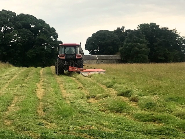
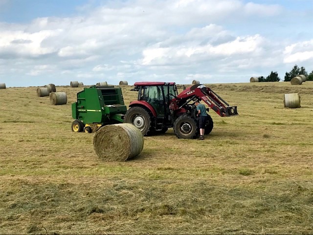
Finally….We wake every day this week with the divine scent of new mown hay wafting over the wall from the meadow named after our house. It’s the farm’s largest and flattest pasture and the one that provides the best haul of hay, year on year. One day it’s cut, a few days later woofled, (turned to help dry). After a few more days, with the gorgeous weather holding, the cut grasses are turned again then rowed up for collection by the baler which deposits those big rolls you see randomly about the place like so many giant draughts pieces.
Crows and gulls move in to quarter the newly exposed ground for worms and insects. Age, heat and dust take their toll on the old tractor so progress is slowed when it demands attention. There’s a new hay barn up at Southridge and over the next few days the tractor will stack and pull trailer loads up there to store in preparation for the long winter ahead.
UPDATE: On returning from holiday in Scotland at the end of August I was surprised and delighted to find a small herd of cows and calves grazing in our field. Our good hearted resourceful neighbour had put them there, knowing that company would help confine them. As an added precaution against escape he also used baler twine to extra secure our garden field gate. Later tells us that because the bottom spring doesn’t provide enough water he’s put a bowser (water tank) in at the gateway to his neigbouring field. We hope now that once they’ve munched through the grass the cattle will move on to graze the tougher stuff that sheep avoid like sedges, young thistles and soft rush.
A brief summary of the past month’s wild animal activity in our out-by rural garden. The big advantage of having no dogs or cats on the premises increases chances of encountering wild animals and the privilege it brings of seeing them up close.
New born leveret: Image by wildwelfare.org.uk
Star event has been the up close sighting over three evenings of baby hares – leverets – hanging out in forget-me-nots that have colonised gravel paths between house and hedge. Our viewpoint from the pantry window being just a few yards away. I’ve not the equipment to capture images in near darkness, but the youngsters intimate interaction is engraved in the memory. Best night ‘s observation was the second. Four of the brood bundled together grooming each other’s fur while a fifth, just a foot away, lay facing out into the gathering dark. Was it keeping watch for their dam or on guard duty for predators? Whatever the reason the outrider eventually came back to its brethren and joined in the ongoing grooming process.
Occasional spotted individual growing leverets since during the day, shooting in and out of close packed flower beds and full leafed copses. The mainstay of family life is their mother, the Jill, who we first saw regularly at Winter’s end. She seemed to have adopted our ever growing garden rubbish tip, t’other side of the fence, as her nursery. Miniature versions of the parents, leverets are born above ground in a shallow depression, or form, and each weighs in around 100 gms (3.5 oz) Unlike rabbits they are fully formed when born, with eyes and ears open. The Jill feeds her litter twice a day but goes foraging, keeping her distance to deter predators like foxes, stoats and weasels from tracking their location. The leverets in turn remain motionless throughout and their colouration helps them blend into the background. They venture out as they grow – as we witnessed – and are fully grown at six months.
When it comes to seeking out the hidden birthplaces of creatures around the garden we were intrigued to see which of the many wrens nests would be the Jenny’s chosen location to lay her eggs. This one amongst the flowerpots won out. Amusing to see the nestlings sporting top knots of moss wrested from their nest lining. Whirring forms of fledglings often seen since about the place. One’s had to be shooed out of the house and others from under the cars in the yard before driving out.
The railway goods waggon that’s our unusual garden shed has in successive years been home to nesting swallows, blackbirds, robins and pied wagtails, each fiercely protective of territorial space. We have indoor residents and under-the-eaves tenants, and thus they co-exist. The wagtails usually opt for either the suspended metal watering can or bucket. The spill of feather, grass and wool lining indicate eventual fledging. Later came across a second wagtail nest within a tangle of rampant clematis, montana rubens, outside the bathroom.
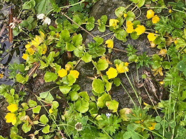
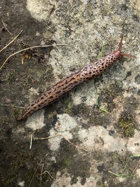
The rain brings amphibians and their ilk out to forage. A frog amongst prostate free flowering lysmachia nummularia at the old pond’s edge one day, or the elegant emergence from cover of a leopard slug on another damp day. There are around forty types of slug in the UK, most of which are not supposed to be crop pests. This one’s beneficial in feeding on a diet of fungi, plant or animal matter and in turn is preyed on by hedgehogs and birds.
I love landscapes of dramatic contrasts, territory where man has made his mark for better or worse over thousands of years. Growing up on the edge of Dartmoor instilled that taste and fed a curiosity to discover more. My predecessors had worked its quarries for stone and extracted its mineral wealth through mining so I love any opportunity to get reacquainted with such a diverse multi-layered history. The 365 square miles that make up the Dartmoor National Park is the largest area of natural open land in the south of England, with a fascinating story of evolution and settlement. It was certainly a compelling reason to choose Dartmoor as a ‘Mastermind’ semi-final subject back in 1991 and I loved doing the research.
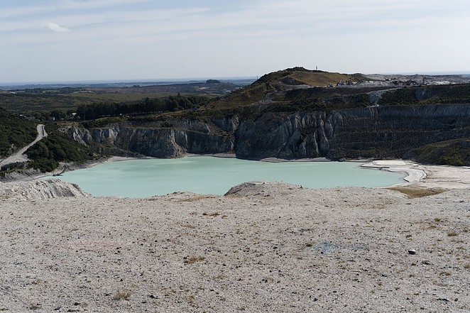
Image of Lee Moor pit by Mindat.org
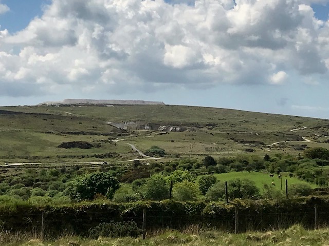
So, here we were, on the last leg of this holiday, coming away from the South Hams through Ivybridge, following the twisting B road that hugs the southeast contours of Dartmoor, heading for Tavistock on its western side. At Shaugh Prior the high banked hedges give way to wide highways and verges floured with dust from endless lorry loads of clay product. Looming above steep slopes of oak woodlands are waste tips of sand and stent (waste rock) produced over many years by the Lee Moor China Clay works. Extraction is by ‘wet mining’ in vast pits using high pressure hoses to create a slurry which is filtered to extract the fine soft white clay prized for its low plasticity. Huge amounts of waste are created in the process, hence the ‘mountains of the moon’ landscape that characterises this corner of Dartmoor.
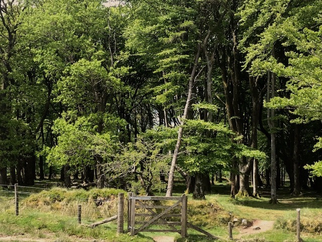
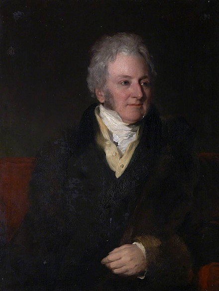
We parked inland, north of the works, by Brisworthy plantation. I was expecting to find a block of conifer. Many such plantations were established on ‘unproductive’ moorlands nationwide by the Forestry commission in the wake of WW1 to help meet the nation’s shortage of timber. Brisworthy though, it turns out, is a mature plantation of deciduous wood, walled and fenced, consisting mainly of beech, planted in the C19th. I think it must have been Lord Morley, the major local landowner, who was responsible, following the fashion for beech tree planting by his contemporaries, most notably on Exmoor.
;John Parker (1772-1840), 1st Earl of Morley by FR Say; National Trust, Saltram House
It was also Lord Morley who granted Cornish entrepreneurs China Clay extraction rights back in the 1830’s. Dartmoor is a massive eroded plateau of granite and over millions of years its gradual decomposition results in the formation of kaolin. It’s essential for making bone china, hence the alternative name, and is also used to manufacture products from paint and paper to cosmetics and toothpaste.
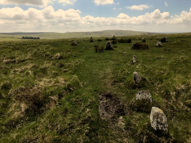
We were curious to see what antiquities could be discovered on this short circular walk. The area of the Upper Plym valley – some 6 square miles – boasts over 300 Bronze Age, medieval and later sites. Our first stop was one of these special places, Brisworthy stone circle. I think it may be a surprise to many, me included, that so many of Dartmoor’s 90 recorded stone circles have been extensively restored. Brisworthy is no exception. Back in 1909 pioneering archeologists put 17 of the original fallen granite blocks back in their holes, to join those still standing. There’s a gap where a couple are missing and these are now thought to form part of the neighbouring field wall.
That stout hedge bank has been the subject of extra protection from grazing by pole and barb fencing, allowing plant life to regain a footing. In amongst the whortleberries, foxgloves and gorse there’s a metal sign to remind us that the Ministry of Defence use Ringmoor Down for ‘dry training’ (exercises using blank ammunition) The army has been using great swathes of the remote high moor for military training since mid Victorian times.
Crossing Legis Lake (stream) by the ford was a minor challenge, the ground being very uneven. Obvious signs of disruption where streaming for tin ore (cassiterite) had occurred during the middle ages when the moor was northern Europe’s principal source of tin. The earliest written record of tin mining on Dartmoor in 1158 references activity here at Brisworthy and nearby Sheep’s Tor.
Legis Tor is surrounded by clitter (granite scree) so requires surefootedness. Good view from the summit, or rather, summits. Waste tips and Plymouth one way, the bare sweep of moorland around the upper Plym valley with cattle grazing, the other way. The granite here on Legis Tor has a pinkish tinge that sunrise and sunset would pick up to add extra glow to its profile. Who knows, maybe that gave the landmark extra cache back in the Neolithic and Bronze ages to attract humans to settle on its slopes.
Legis Tor vermin trap image by Richard Knights / Dartmoor Walks website
So dense the amount of granite blocks and clitter that I searched in vain to find the perfectly preserved vermin trap the eminence is noted for. This area was developed from the 15th century on an increasingly large scale as a site for farming rabbits. These warrens needed protecting from natural predators like stoats and weasels, hence the traps at boundaries. Basically, granite boxes with channels leading to a slate door that could be sprung to trap intruders. Medieval farms were converted to house rabbits and hares. Thin topsoil over solid granite stopped them burying out while earth and granite ‘pillow mounds’ kept them penned in. Clearly, the factory farming of its day! Of Dartmoor’s historic warrens six of them are to be found here in the Upper Plym valley. Maybe the proximity to markets in Plymouth was the deciding factor in establishing them hereabouts.
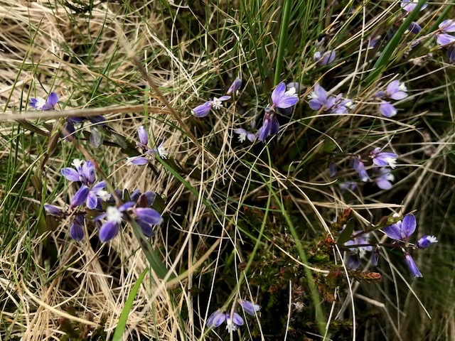
The flora of Dartmoor is typical of damp acid soils, with plants like the ground hugging yellow flowers of tormentil, able to survive in amongst tough grasses hard grazed by ponies, sheep and cattle. Heath milkwort, with its pretty blue and white flowers, caught my eye. It was prescribed by medieval herbalists to nursing mothers in the belief that it made ‘milk more abundant’. The idea came via its Greek name for ‘much milk’ from the effect it had on cows grazing it.
Reave Boundary Bank
Returning on a parallel route we traced the intersection of two reaves, or ancient earth boundary banks. Another stone circle – Ringmoor – complete with stone row revealed itself in amongst the heather and bracken. Restored in the early part of the C 20th by the famous curate and squire of Lewtrenchard manor, the Rev. Sabine Baring Gould (Composer of ‘Onward Christian Soldiers’). By all accounts it was done with more enthusiasm than understanding…Oh dear. It still has an appeal to passing walkers like us though.
Thought of the hardy folk who lived here, and the remains of their round houses and animal pounds. People who constructed those rows and circles for their rituals and how gradually they exhausted the supplies of timber, effectively causing an ecological disaster, so that they moved off the moor to the valleys below, clearing and settling again, using the denuded high land as summer grazing grounds. And so the appearance of the landform developed to be more like it is today.
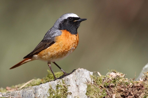
Redstart Image Margaret Holland / The Wildlife Trusts
Returning to Brisworthy plantation we met a wildlife photographer setting off with her extensive kit, who told us the wood is home to migrant birds like pied flycatcher and redstart that breed here. The latter has a special fondness for the mild wet conditions found in the temperate rainforests of the UK’s western coastal areas. Ponies and their foals were in evidence too, grazing the woodland boundary banks. We were lucky to have such a fine day to enjoy the views and discover the archaeology, dry under foot with no mist or fine rain to lead us astray. Enough was experienced in our few hours ramble to keep me going until the next opportunity arises to rediscover another part of the place I still call home in my heart.
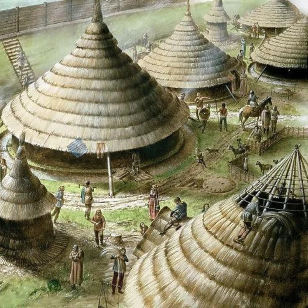
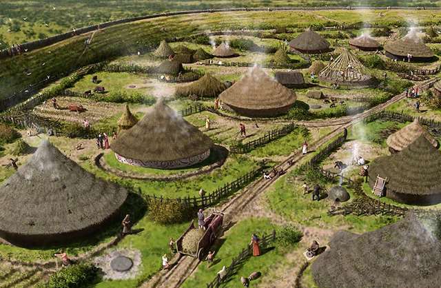
There are over 1200 hill forts in England. Mostly built in the Iron Age, between 900 BC and the Roman Invasion in the first Century AD. Their construction seems to reflect an age of increased conflict fuelled by a growing population, in stronger tribal groupings, disputing rights over land and resources. Some hill forts were built on earlier Neolithic causeway enclosures, some incorporate burial barrows. They all vary greatly in size, form, defensive strength and number of occupants, from a handful of families to a whole community hundreds strong, plus assorted livestock & food stores.
Reconstruction of iron Age fort: Image credit Explore GB
The Roman occupation may have put an end to native tribes setting up fortresses that could threaten imperial rule but some of these distinct man made features were reused beyond their own era. Just up the road from where we were staying, north of the village of Loddiswell which is itself situated on a hillside, there is one such place, and we were keen to pay it a visit.
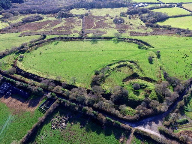
Blackdown Rings, 600 feet above sea level, gives distant views over a wide swathe of South Hams countryside, from Dartmoor to the north, southwards to the coast and slopes down to the valley of the Avon, or Aune, river that physically connects the two. In ancient times this valley would have provided a trade route and rich hunting grounds, so clearly well worth overlooking and hence, controlling. A great location for a defensive settlement atop its gritstone summit.
Ariel Image by Richard Hook
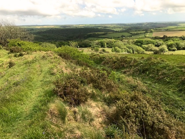
The former fort extends over 6 acres (2.45 hectares) defined by an earthwork rampart with external ditch and counterscarp bank, these days picked out by hawthorn and other tough little trees. What makes it special is that the Normans, following their conquest of England in 1066, adapted the N.W. corner of the site as a motte and bailey castle. Like many a visitor before us we had to ascend the man made mound (motte) to overlook the immediate enclosure (bailey) with the larger original enclosure sloping away beyond. Presumably that wider enclosure would have secured their livestock and supplementary facilities. No permanent settlement evolved over time in this case, that wood walled military command base never became a permanent stone structure and this stretch of high land on hard rock resorted to heath and pasture.
View from the top of the motte
Today ewes and their lambs graze the slopes and the land is owned and managed by a charitable trust named after the site’s former owner Sir Matthew Arundell, whose will of 1591 bequethed it ‘for the good and behoof of the parishioners of Loddiswell.’ Combined with other parish lands the income raised from investments down the centuries support a range of village causes. Here at Blackdown Rings all the information boards were paid for out of the trust’s funds.
The Line crossing lane near Loddiswell. Image: Coast and Country Cottages
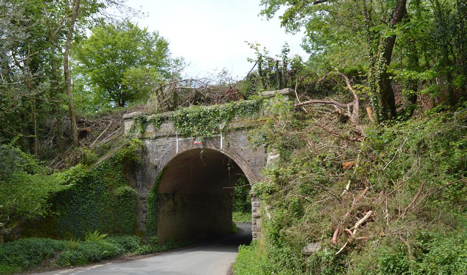
Time caught us short on this holiday or we would have extended the original intention to walk the waymarked paths along the wooded Avon valley at our feet as it has a fascinating modern history. The former railway branch, known as the ‘Primrose Line,’ once wove a scenic journey from its junction with the Plymouth/Exeter mainline at South Brent, via a tunnel into the Avon valley, intertwining with the river and on across to Kingsbridge. Despite a spirited local campaign to turn it into a heritage line the 12 miles of track were raised and removed after closure in 1963, an early victim of the Beeching cuts.
Former railway line crossing the Avon in the woods
The same era that saw a third of Britain’s rail lines closed down also saw a huge increase in the planting of commercial conifer, encouraged by tax breaks. This was often achieved at the expense of ‘unproductive’ deciduous woodlands that could be cleared to make way for them. Protesters in different locations across the country banded together to oppose the trend and in this corner of Devon local residents led by Kenneth Watkins formed The Woodland Trust to do just that.
River Avon woods. image: The Woodland Trust
Today we were looking over some 344 acres of ancient, semi-natural and newly planted woodlands that the trust own and manage here in the Avon valley. One of those woodlands, the very first to be purchased and saved from clear felling back in 1972, has been re-named Watkins Wood in honour of the charity’s founder. It’s one of 1,000 woods open to the public that the Woodland Trust manage nationwide in 2024, thanks to the combined efforts of its 500.000 members and supporters.
Maiden Castle Reconstruction. Image: English Heritage
Footnote: Bemused to learn when researching this entry that the top three hill fort hotspots in England are in Northumberland (where I live) with 271 recorded sites, Devon (where grew up) with 89 and Cornwall (where born) with 77. So, plenty more to discover yet!
‘He that prays and preaches best will fight best’ Oliver Cromwell.
We were staying on the inland side of Aveton Giffard and returning from our day at Ringmore and Ayrmer cove, stopped off to discover more about the place, off the roundabout on the main road, near where the River Avon turns tidal.
Walter Giffard was a serious backer of William of Normandy’s invasion of England in 1066 having provided 30 ships and 100 Knights. Giffard (the name means ‘chubby cheeks’ in old French) was richly rewarded by the Conqueror. The ton, or settlement, on the Avon was one of hundreds of manors granted him. Walter went on to become one of the King’s commissioners responsible for compiling the Domesday Book. Later, in 1178, the Giffard family added Challington in Staffordshire to their tally of land. Boscobel – that I wrote about four diaries ago – was part of that estate. Remarkably Challington remains the Giffard family seat.
The Road Bridge at AG – Photo credit Barry Deakin / Creative Commons
Aveton Giffard – AG – lies at the tidal high reach of the River Avon, and is the lowest crossing point, originally by a ford over bedrock, and from the C15th by a bridge. That bridge, widened and strengthened is now the A379 today, linking the market towns of Modbury and Kingsbridge.
Civil War Musketeers Recreation. Photo Credit: The Sealed Knot
When Civil War broke out in 1642 the towns in the far south-west by and large sided with Parliament and the rural areas tended to favour the King’s side.In the last diary I mentioned the Royalist rector of Ringmore, Reverend William Lane, who, as it happens was also Rector of AG and equally active in raising a Royalist militia here. He had a small wooden stockade built on one the hills on glebe (church) land overlooking the vital river bridge, intending to halt Parliamentary forces crossing. However, the range and power of their muskets was insufficient to stop the Roundheads, and the bridge and village was taken and the clergyman and his men had to retreat in haste. It was for this act of resistance, as well as his activities in Ringmore, that caused him to be a fugitive, as described in my last diary.
We started our stroll downstream from a car park, formerly the site of a sawmill. On the opposite bank is some 42 acres of former grazing marsh, a nature reserve today, run by Devon wildlife Trust. The site’s name, South Efford, betrays its origins as the river’s southernmost fording place at ebb tide. We followed the single track tarmaced road, hugging the shallow winding waters, and which floods every high tide, as the roadside markers clearly demonstrate. Before the road was built walkers used irregular stepping stones, known as ‘the dog biscuits’ to pass over the marsh. This is clearly not a place to get stuck or ‘run the tide’ and there are few passing places.
Danish Scurvygrass growing on the edge of the tidal road
The Avon, or Aune, is one of the many Devon rivers that rise on Dartmoor and end their course as Rias, or sunken river valleys. Avon or Afon in Welsh means river in old English. Some 23 miles long, with the last three miles of its course as a sunken river valley, or Ria. This opening up as shallow estuary, bordered by marsh pasture and steep sided wooded hillsides makes for a topography that is particularly rich in animal, bird and marine life. Because of that the estuary itself was designated a Marine Conservation Zone (MCZ) by DEFRA in 2019.
A little egret caught our attention as it fished the mud with a studied long limbed urgency, but the most striking sight to meet our eyes were two two yachts that had somehow come to grief, marooned on mudbanks mid-stream. Their slimy green glow lent a distinctly haunting presence to the waterway here at low tide. A sharp contrast to the smart little motorboats we saw their proud owners happily working away on.
More time and we’d have made a circular walk of it, coming back via woods and fields over the down with the views of village and valley it would have offered. Incredibly Aveton Giffard’s narrow winding Fore Street of cream coloured terraced houses carried the A379 right up until 1990. Small wonder the villagers held a street party here when the by-pass opened.
Fore Street, Aveton Giffard. Image: Tony Atkin/Creative Commons
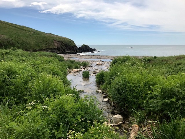
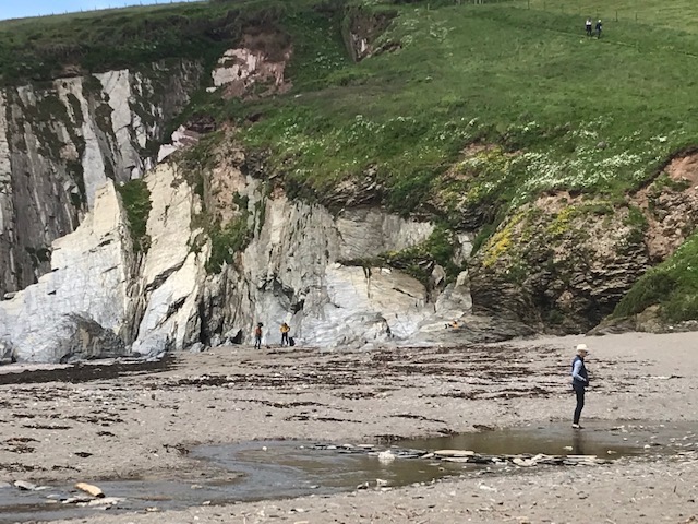
No west country holiday is complete without a swim in the sea. As a weak swimmer I rarely goes out of my depth. The ideal spot needs to have a gradual incline, without strong tides, sheltered and preferably not crowded. I found such a place here, at Ayrmer cove. A grey shingle beach where a stream meets the sea, defined either side by cliffs composed of huge slate slabs dating from the Devonian era, formed between 395 – 345 million years ago.
The sublime joy of letting go, diving then floating, eyes closed, limbs akimbo, bobbing about on the lapping waters of the little bay. Then, about to wade ashore, re-opening eyes to the wide blue yonder, there’s a brimstone butterfly riding the breeze just above my head, a happy symbol of this sensual interlude.
Kidney Vetch by the beach
Once again thanks are due to the National Trust for owning and maintaining such a place. (On leaving we passed a van’s worth worth of cleared flotsam and jetsam stacked ready for collection). The 20’ walk from the Trust’s landscaped car park on a cul-de-sac outside Ringmore village and the lack of any facilities might also explain its quiet unspoilt state. A few dog walkers, occasional passing ramblers on the coastal trail, and a handful of bathers under the cliffs. Just perfect.
We’d taken one track down the valley, between banks of flower filled hedges, and returned via the field path running parallel on the other side of the little valley. Cows with calves at foot grazed contentedly, hock high in lush meadows brightened by kingcup and other marsh plants. We ambled with our gear, entering cooling woodland shade awash with ferns, before the final ascent back to Ringmore.
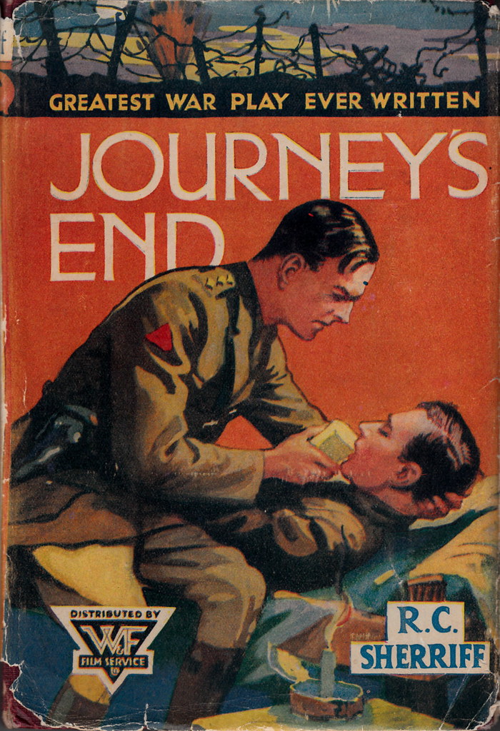
This must be one of the prettiest of Devon’s ancient villages, with many a thatched cottage proudly kept and no street lighting along its narrow circling thoroughfares more like paths than roads. The ‘Journey’s End’ pub enjoys a great reputation for its evening meals (The chef and his family live permanently on site, which might help explain why) It’s named after the seminal play set on the Western front in WW1, first performed in London’s West End in 1929. Certainly proved a fitting place to complete our lovely sea blessed outing today.
Based on his own experience as an officer in the conflict, R.C.Sheriff (1896-1975) wrote ‘Journey’s End’ while staying on holiday here and the New Inn (already ancient) was subsequently renamed in its honour. An archetypal old building of low beams, nooks and crannies I fancied it oddly reflective of the officers’ mess in the trenches where the play’s action is set. I wondered if, back in the 1920’s, it might have put Sherriff in mind of that place he knew so intimately and could evoke so powerfully through drama.
Histories of past conflicts affected the parish church too, or rather one of its rectors. All Hallows is a venerable building too, though much restored. In 1637 a new incumbent was appointed Rector here. William Lane was a staunch Royalist who, when civil war broke out in England in 1642, set to raising and training a village militia for King Charles’ cause. In retaliation for his guerrilla action in the area a detachment of troops sailed up from Parliamentary HQ in Plymouth, landed at Aymer Cove, marched up the valley, set fire to the Rectory and arrested Reverend Lane’s two eldest sons. The man himself spent the next few weeks hiding in the Church Tower, aided and supported by loyal parishioners, before making his escape to France. Loved this story for its parallels with the other tales of Royalist rebellion and rout we’d encountered on this holiday, from Boscobel to Colyton….And it doesn’t end there.
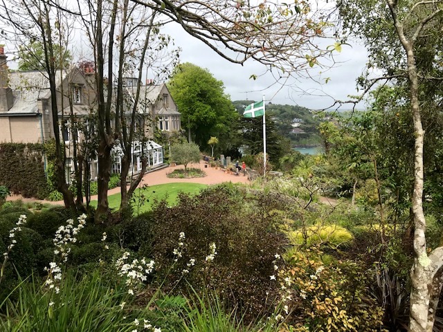
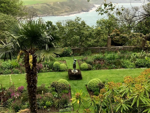
Now in the care of the National Trust, Overbeck’s consists of 3.5 acres of terraced gardens set on a precipitous rocky hillside outside Salcombe, giving fabulous views over the extensive Kingsbridge estuary – a great example of a sunken river valley, or ria. Its sheltered position allows semi-tropical and tender plants to flourish and a team of three gardeners backed up by volunteers do an effective job in both maintaining and enhancing this special horticultural haven.
Each garden room opens to another as you rise up or step down to enter them. The contrast of tall semi-tropical trees and native foliage is striking. The green, white and black County flag reminding us of the Devon Riviera location.Trees planted more over a century ago in the woodland area, laced through with winding paths and hidden viewpoints, have added more privacy as they’ve grown to maturity, as well as providing extra shelter.
Otto Overbeck Self portrait oil on canvas .1902
The garden created around the house known as ‘Sharpitor’, built in the 1890’s, was used in WWI as a convalescent home for wounded soldiers. The estate was left to the Trust in the will of wealthy scientist and inventor, Otto Overbeck (1860 – 1937) who had retired here in 1928. He had made a fortune through his patented medical therapy of ‘electric rejuvination’ and this funded further development of the garden complex that bears his name today.
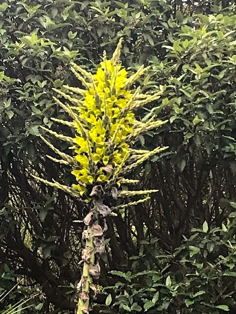
Our attention was drawn to an example of puya chilensis, a member of the pineapple family, flowering now for the first time in twenty years. In its native South America small birds and mammals seeking nectar act as pollinators, and sometimes they end up feeding it too. The leaves have vicious inward facing barbs so any unfortunate creature getting caught by them only adds to its diet.
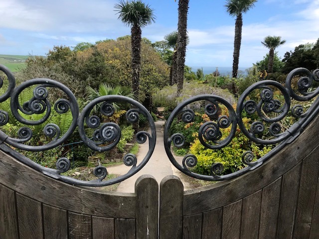
Liked the decorative ironwork that around the place, that adds a distinctive playful touch, the creation of a local blacksmith. His work ranges from curly-wurly handrails to concave gate toppings and stencilled sign over the steps leading down from the entranceway. Another graceful touch is the century old bronze figure known as ‘First Flight’ in the garden’s largest flat area – a former tennis court – now appropriately enough known as the statue garden.
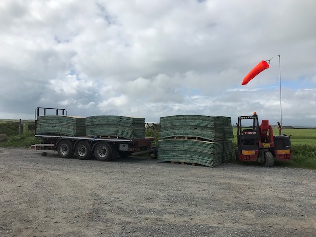
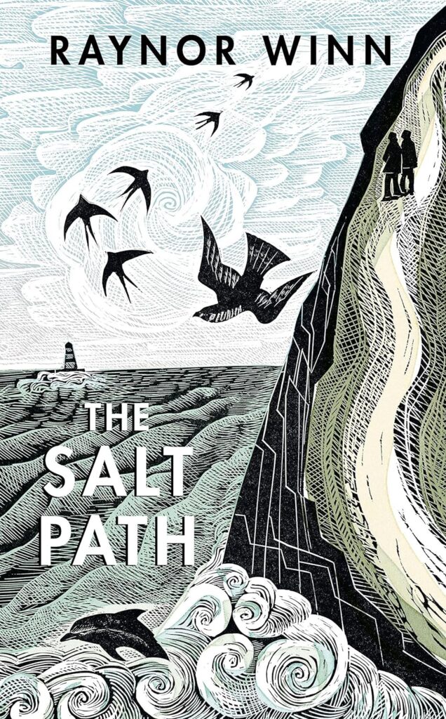
Parking at Overbeck’s is very restricted so we walked a mile or so there and back from the car park at east Soar, inland out on the headland, which opened our eyes to other fascinating aspects of the topography. The car park was doubling as a depot for all manner of trucks bearing the full range of kit needed for filming a major motion picture on location. We worked out that it was ‘The Salt Path’.
The book by Raynor Winn tells the story of her and husband Moth’s trek along the length of the south-west coastal path from Minehead to Poole at a time when they were homeless, and he had an illness diagnosed as being terminal.
A publishing sensation it is being filmed over the course of a year, starring Gillian Anderson as her and Jason Isaacs as him. What you’re looking at above are a stack of interlinking flooring used to minimise impact of equipment and facilities on a protected landscape like the coastal path.
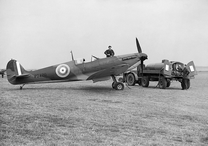
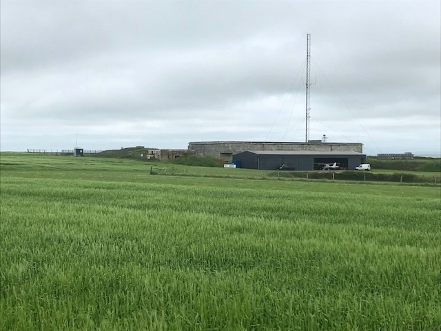
Wide farm fields today stretch towards the sea but this place was once a hive of activity after RAF Bolt Head was constructed here in WW2. This fighter base on the English Channel, home to spitfires and typhoons, was at its busiest in the lead up to D-Day – Operation Overlord – whose 80th anniversary we will be marking on June 6th.
The military aerodrome closed in 1947, replaced by a smaller private facility for light aircraft. We were amused to see a Range Rover pulling a cutter at speed, back and forth, along the strip bordered by a cereal crop, maintaining peak grass performance. The original strip was built on a layer of sheep’s wool overlaid with metal grid. I’m wondering if that’s still in place under the grass.
Heartened to see the NT rangers have been reconstructing lost hedge banks. These would have been original field boundaries, grubbed out to accommodate the construction of the wartime air base. With native varieties of shrub planted on top, in time the traditional deep hedge banks should look as if they’ve always been there.
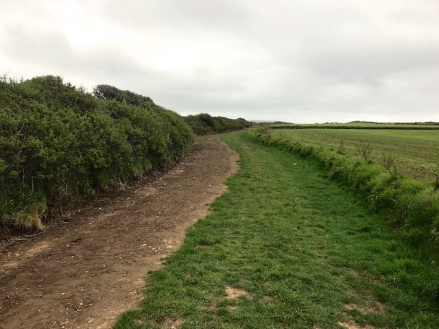
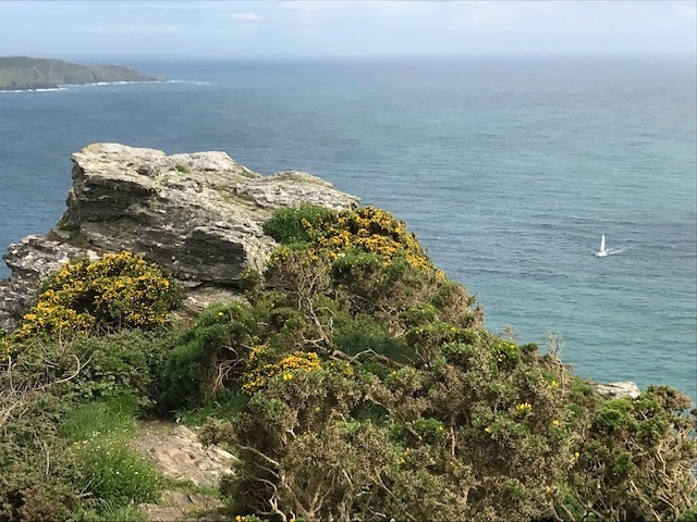
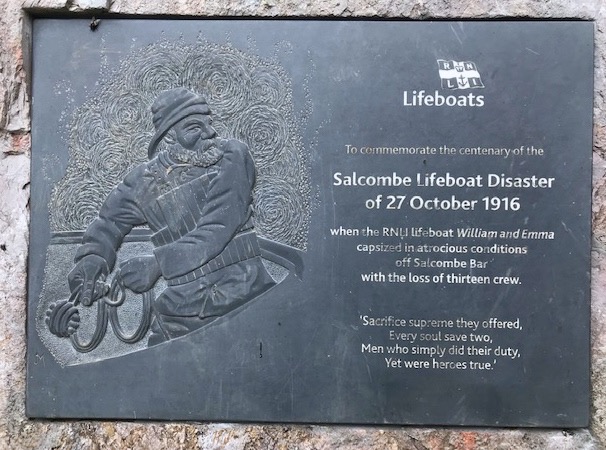
Leaving Overbeck’s we climbed steeply by path and steps to gain the high open spaces skirting Bolt Head. And what an impressive stretch of coastline it is. A simple plaque on a viewpoint overlooking the estuary reminded us of how fiercely powerful the elements can be and the immense bravery of those who risk their lives to save others from natural disaster.
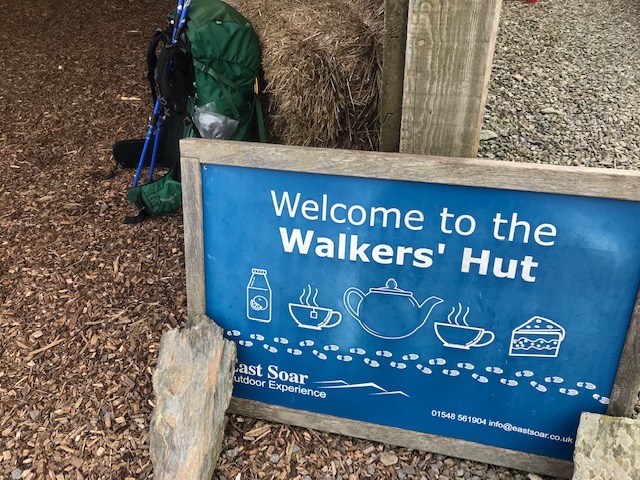
There are fantastic views from the coastal path to be enjoyed on a lovely clear day. Turning off for the car park inland, we threaded through traditional meadowland. A welcome stop off and chats with fellow ramblers at East Soar’s barn.
The farmstead is now run as an outdoor activity centre for young people and other groups, with goats, sheep and other farm animals for the young people to encounter and learn about. They even host weddings in the barn. A last stretch back along the straight access track to the car and we were away. Another wonderful day on the Devon coast, with special thanks to the National Trust for helping making it so at every turn.