I love landscapes of dramatic contrasts, territory where man has made his mark for better or worse over thousands of years. Growing up on the edge of Dartmoor instilled that taste and fed a curiosity to discover more. My predecessors had worked its quarries for stone and extracted its mineral wealth through mining so I love any opportunity to get reacquainted with such a diverse multi-layered history. The 365 square miles that make up the Dartmoor National Park is the largest area of natural open land in the south of England, with a fascinating story of evolution and settlement. It was certainly a compelling reason to choose Dartmoor as a ‘Mastermind’ semi-final subject back in 1991 and I loved doing the research.
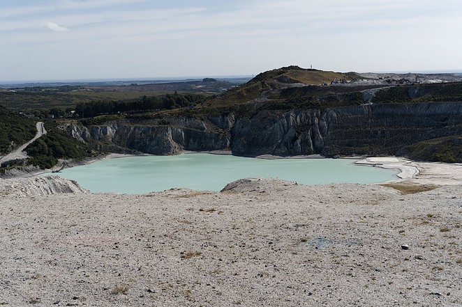
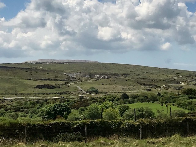
So, here we were, on the last leg of this holiday, coming away from the South Hams through Ivybridge, following the twisting B road that hugs the southeast contours of Dartmoor, heading for Tavistock on its western side. At Shaugh Prior the high banked hedges give way to wide highways and verges floured with dust from endless lorry loads of clay product. Looming above steep slopes of oak woodlands are waste tips of sand and stent (waste rock) produced over many years by the Lee Moor China Clay works. Extraction is by ‘wet mining’ in vast pits using high pressure hoses to create a slurry which is filtered to extract the fine soft white clay prized for its low plasticity. Huge amounts of waste are created in the process, hence the ‘mountains of the moon’ landscape that characterises this corner of Dartmoor.
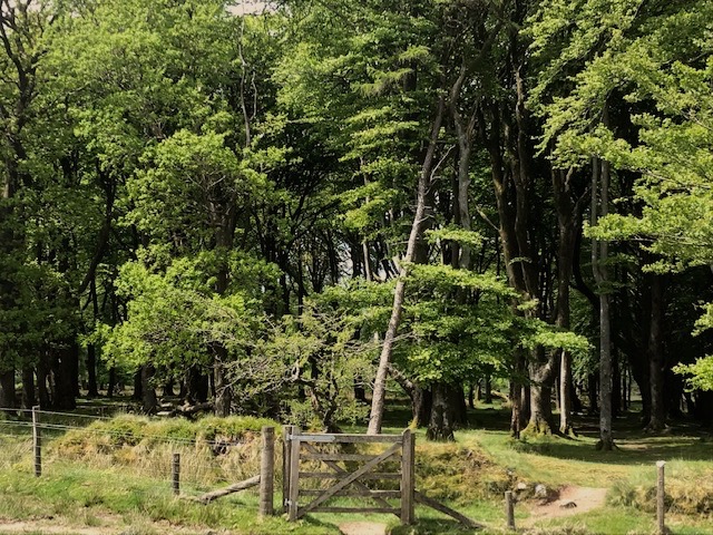
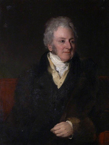
We parked inland, north of the works, by Brisworthy plantation. I was expecting to find a block of conifer. Many such plantations were established on ‘unproductive’ moorlands nationwide by the Forestry commission in the wake of WW1 to help meet the nation’s shortage of timber. Brisworthy though, it turns out, is a mature plantation of deciduous wood, walled and fenced, consisting mainly of beech, planted in the C19th. I think it must have been Lord Morley, the major local landowner, who was responsible, following the fashion for beech tree planting by his contemporaries, most notably on Exmoor.
It was also Lord Morley who granted Cornish entrepreneurs China Clay extraction rights back in the 1830’s. Dartmoor is a massive eroded plateau of granite and over millions of years its gradual decomposition results in the formation of kaolin. It’s essential for making bone china, hence the alternative name, and is also used to manufacture products from paint and paper to cosmetics and toothpaste.

We were curious to see what antiquities could be discovered on this short circular walk. The area of the Upper Plym valley – some 6 square miles – boasts over 300 Bronze Age, medieval and later sites. Our first stop was one of these special places, Brisworthy stone circle. I think it may be a surprise to many, me included, that so many of Dartmoor’s 90 recorded stone circles have been extensively restored. Brisworthy is no exception. Back in 1909 pioneering archeologists put 17 of the original fallen granite blocks back in their holes, to join those still standing. There’s a gap where a couple are missing and these are now thought to form part of the neighbouring field wall.

That stout hedge bank has been the subject of extra protection from grazing by pole and barb fencing, allowing plant life to regain a footing. In amongst the whortleberries, foxgloves and gorse there’s a metal sign to remind us that the Ministry of Defence use Ringmoor Down for ‘dry training’ (exercises using blank ammunition) The army has been using great swathes of the remote high moor for military training since mid Victorian times.

Crossing Legis Lake (stream) by the ford was a minor challenge, the ground being very uneven. Obvious signs of disruption where streaming for tin ore (cassiterite) had occurred during the middle ages when the moor was northern Europe’s principal source of tin. The earliest written record of tin mining on Dartmoor in 1158 references activity here at Brisworthy and nearby Sheep’s Tor.

Legis Tor is surrounded by clitter (granite scree) so requires surefootedness. Good view from the summit, or rather, summits. Waste tips and Plymouth one way, the bare sweep of moorland around the upper Plym valley with cattle grazing, the other way. The granite here on Legis Tor has a pinkish tinge that sunrise and sunset would pick up to add extra glow to its profile. Who knows, maybe that gave the landmark extra cache back in the Neolithic and Bronze ages to attract humans to settle on its slopes.
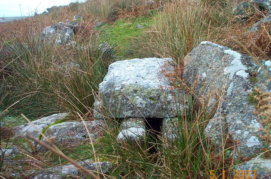
So dense the amount of granite blocks and clitter that I searched in vain to find the perfectly preserved vermin trap the eminence is noted for. This area was developed from the 15th century on an increasingly large scale as a site for farming rabbits. These warrens needed protecting from natural predators like stoats and weasels, hence the traps at boundaries. Basically, granite boxes with channels leading to a slate door that could be sprung to trap intruders. Medieval farms were converted to house rabbits and hares. Thin topsoil over solid granite stopped them burying out while earth and granite ‘pillow mounds’ kept them penned in. Clearly, the factory farming of its day! Of Dartmoor’s historic warrens six of them are to be found here in the Upper Plym valley. Maybe the proximity to markets in Plymouth was the deciding factor in establishing them hereabouts.
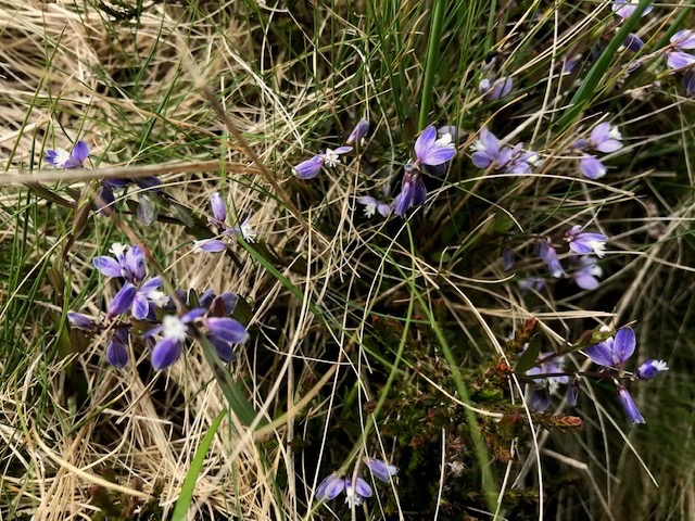
The flora of Dartmoor is typical of damp acid soils, with plants like the ground hugging yellow flowers of tormentil, able to survive in amongst tough grasses hard grazed by ponies, sheep and cattle. Heath milkwort, with its pretty blue and white flowers, caught my eye. It was prescribed by medieval herbalists to nursing mothers in the belief that it made ‘milk more abundant’. The idea came via its Greek name for ‘much milk’ from the effect it had on cows grazing it.

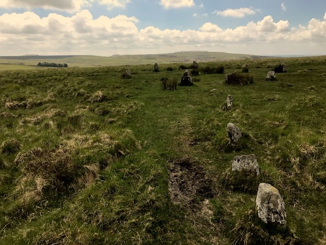
Returning on a parallel route we traced the intersection of two reaves, or ancient earth boundary banks. Another stone circle – Ringmoor – complete with stone row revealed itself in amongst the heather and bracken. Restored in the early part of the C 20th by the famous curate and squire of Lewtrenchard manor, the Rev. Sabine Baring Gould (Composer of ‘Onward Christian Soldiers’). By all accounts it was done with more enthusiasm than understanding…Oh dear. It still has an appeal to passing walkers like us though.
Thought of the hardy folk who lived here, and the remains of their round houses and animal pounds. People who constructed those rows and circles for their rituals and how gradually they exhausted the supplies of timber, effectively causing an ecological disaster, so that they moved off the moor to the valleys below, clearing and settling again, using the denuded high land as summer grazing grounds. And so the appearance of the landform developed to be more like it is today.
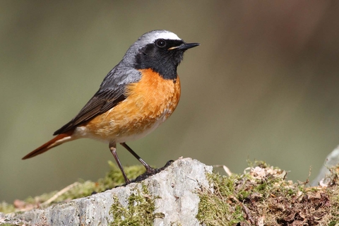
Returning to Brisworthy plantation we met a wildlife photographer setting off with her extensive kit, who told us the wood is home to migrant birds like pied flycatcher and redstart that breed here. The latter has a special fondness for the mild wet conditions found in the temperate rainforests of the UK’s western coastal areas. Ponies and their foals were in evidence too, grazing the woodland boundary banks. We were lucky to have such a fine day to enjoy the views and discover the archaeology, dry under foot with no mist or fine rain to lead us astray. Enough was experienced in our few hours ramble to keep me going until the next opportunity arises to rediscover another part of the place I still call home in my heart.
