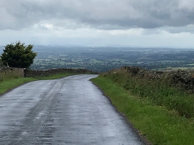
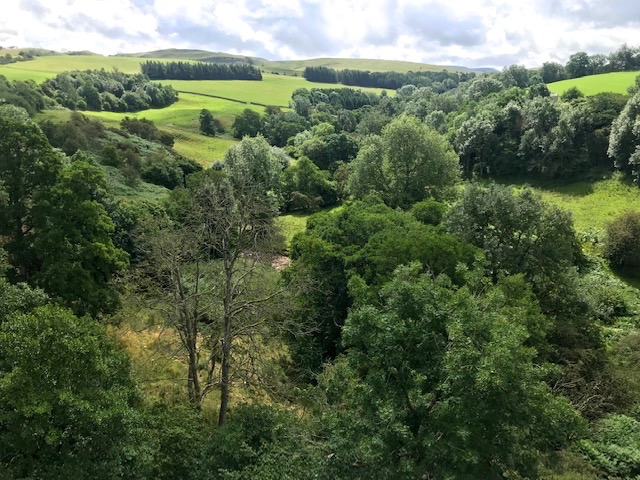
You can’t help but wonder that if the redundant rail line was still operational today would the village’s former community facilities be here too – the pub, shop and café? Staying in a redundant Methodist chapel in the Yorkshire Dales last weekend I mused about the possibility. This particular settlement’s old station has been converted into luxury accommodation with plate glass windows to take in the extensive views west. The line itself is still traceable on its level round the curves course, appearing then disappearing into the mizzling distance.
The South Durham and Lancashire Union Railway opened in 1861 and was operational, under different names, between Barnard Castle and Tebay for the next century. Generally known as the Stainmore line, after its highest and bleakest point, it was designed by leading railway engineer and native of Cumberland, Sir Thomas Bouch (1822-1880). This cross Pennine track transported coal mined in Durham to smelt limestone and iron ore in the furnaces of Barrow-in-Furness. At its peak in the 1880’s a million tons a year passed this way. In the wake of industrial decline after World War II the line closed to passenger traffic in 1962, as part of the infamous Beeching cuts.
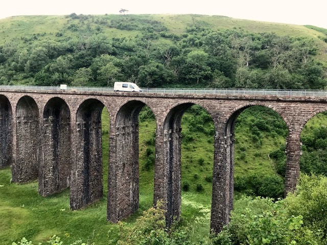
Thanks to the extraordinary efforts of the Northern Viaduct Trust (www.nvt.org.uk) the Stainmore line’s trio of magnificent viaducts around Kirkby Stephen have been saved from demolition and maintained for public access free of charge. In addition, local enthusiasts have restored Kirkby Stephen East station, which sadly we didn’t get chance to visit on this occasion (www.kirkbystepheneast.co.uk) Over two days, despite high winds and rainstorms, we explored sections of the track between and across these wonderful engineering structures.
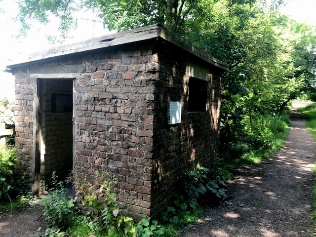
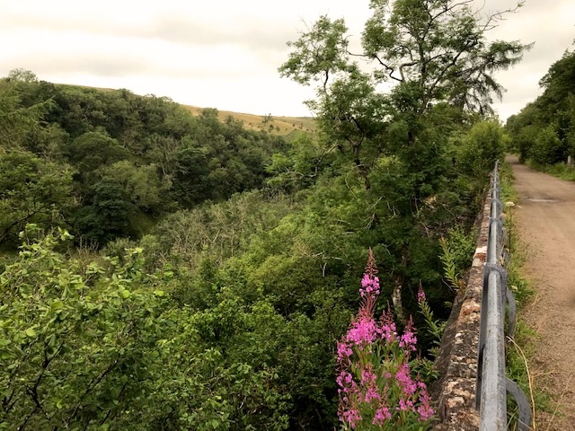
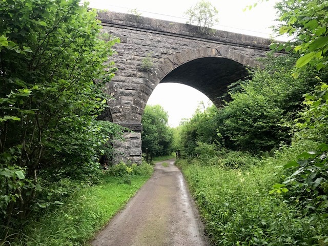
There’s an all weather path – a section of the coast to coast walk – from Kirkby Stephen town centre to the village of Hartley where a steep incline gains access to the old line in woodlands by an active limestone quarry. (The last section of line continued to serve it until 1975) At this point the Merrygill viaduct’s nine arches crosses Hartley beck, 78 feet below. A platelayers hut by the ruined signal box provides visitors with shelter and information about the line and quarrying.
Walking further east you pass under road bridges in cuttings on to the ravine of Ladthwaite beck, spanned by the eleven arches of Podgill Viaduct. Originally built to carry a single line it was widened to double in 1889. There are fine views west over the Eden valley and the Lake District, while to the east a line of dark fells marks the boundary of the Yorkshire Dales National Park.
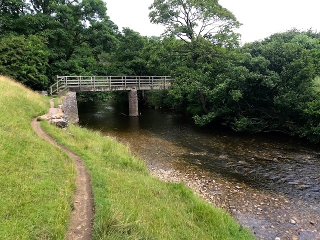
This public section ends a little later where the Stenkrith road bridge crosses both line and River Eden. Since the Millennium a metal and concrete footbridge below it gives walkers mesmerising close ups of naturally occurring holes in the river’s bedrock, through and around which the rushing waters swirl.

Returning to Kirkby at this point we followed the Eden downstream through woods and fields, eventually crossing it by a wooden footbridge.
Onwards by hedge hugging paths, which eventually led into a broad riverside field, featuring a large limestone bank barn.
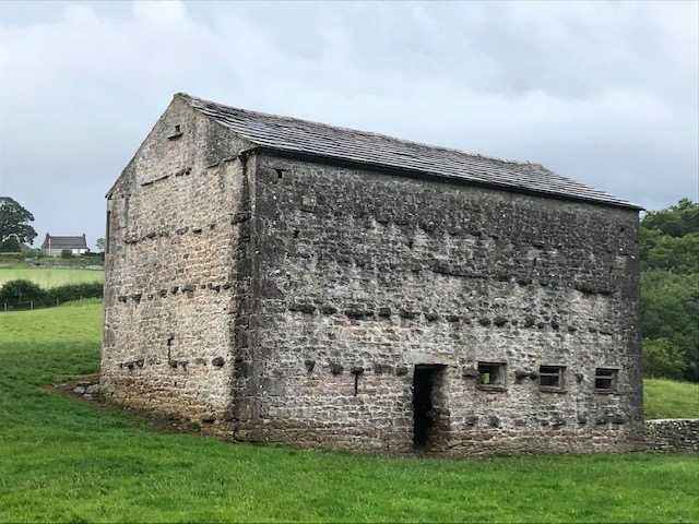
Locally known as ‘cow’uses’ (cow houses) these field barns are distinctive features in the traditional dales landscape. Mostly dating from the C19th, they were used for storing hay and overwintering cattle whose muck was spread over the field each spring to fertilize the next hay crop. This one, being built into the slope, had upper and lower entrances that farm carts could utilise.
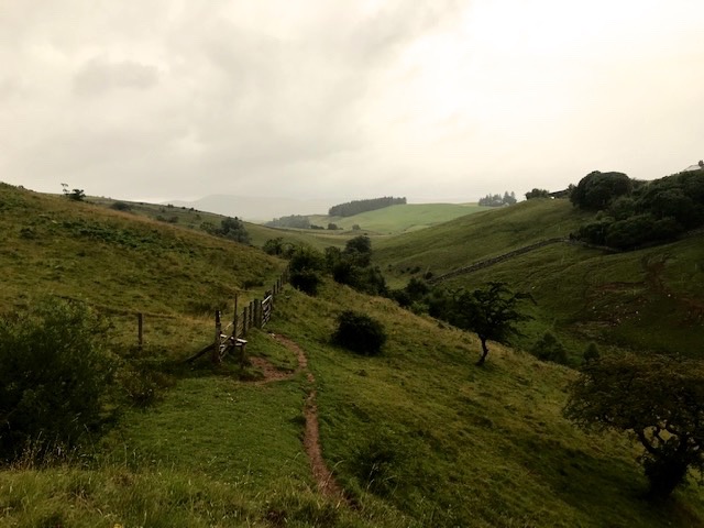
The second leg of our viaduct walk took us a mile or two further westwards along the high line to Smardale, starting and finishing at a car park provided by Cumbria Wildlife Trust. (https://www.cumbriawildlifetrust.org.uk/)
The next mile and a half of track bed passes through their delightful nature reserve. Dense swathes of oak, ash, hazel, birch and sycamore cover the steep hillsides and embankments. Former boundary walls, their coping stones covered in dense coats of moss, are glimpsed between the trees.
Shortly after passing under an arch of Smardale viaduct (the rest of it lost to view in the treeline either side) we heard the welcome rumble of an unseen passing train. The famous Settle & Carlisle line, crossing over north/south. The country’s highest route passing over what was once the second highest. Being rival enterprises back in the 1860’s they didn’t interact and this point was their one and only passing place.
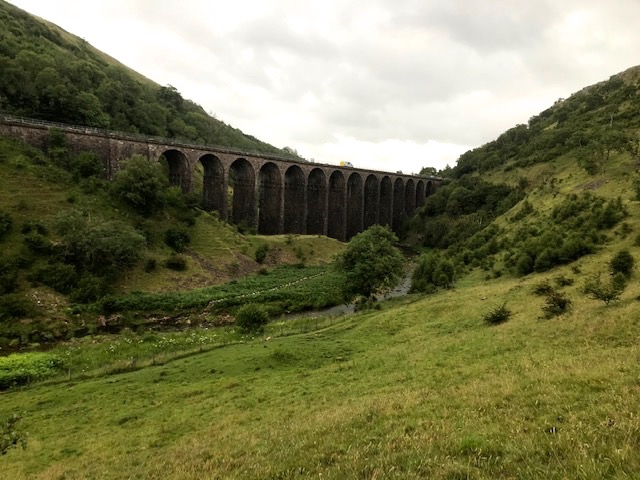
Arrived at Smardale Gill Viaduct to discover contractors in a fleet of vans doing major maintenance work, upgrading the parapet railings and re-pointing the old trackside limekilns further on. This meant we couldn’t cross as planned but needed to divert off track, on to open fell side, free of woodland cover.
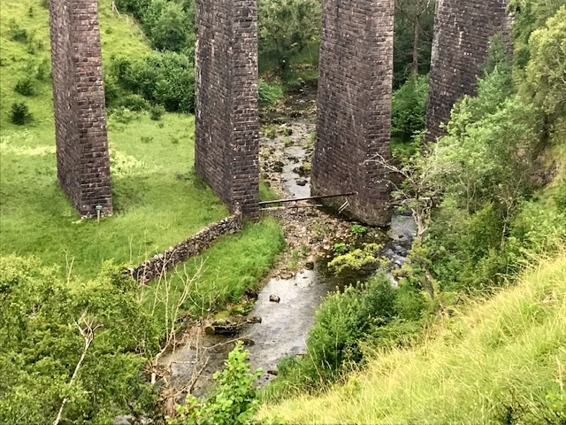
That diversion was a great bonus, focusing attention on the impressive structure of the curving construct, all fourteen arches at a height of 90 ft. above Scandal beck below, flowing over rocks millions of years old. So confident is the design that the footing of one pier is planted not either side of the water but right in it.
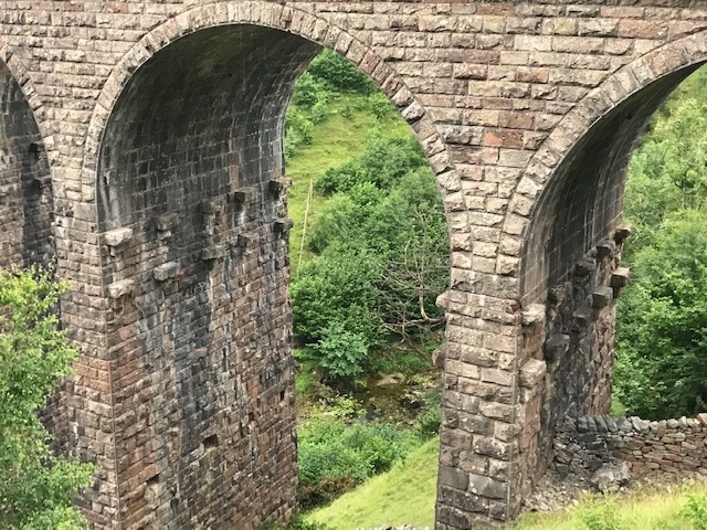
The path also allows you to see courses of corbels on each pier that secured the rough wooden platforms where Victorian navvies once toiled to build the structure skywards to completion.
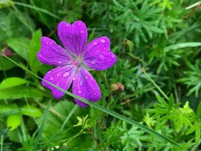
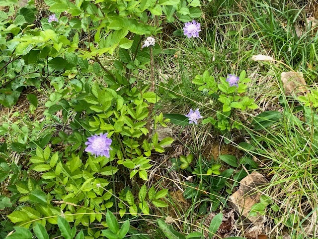
Worsening weather meant abandoning the planned return leg over the exposed flank of Smardale fell and instead we retraced our steps, past track bed verges of many wild flowers the reserve protects and promotes. I particularly liked the mauve tints of field scabious and the bold magenta of bloody cranesbill.
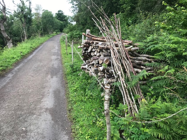
Unsurprisingly, given the inclement weather, there were no signs of the rare Scotch Argus or Northern Brown Argus butterflies that have a welcome safe haven hereabouts. Plenty of fruit flies though which buzzed continuously around our heads as we walked and landed en masse once stopped! Piles of logs and coppiced wood mark the way – perfect habitat for a wide variety of insects that in turn provide food for birds like redstart and pied flycatcher.
A lovely sojourn in a beautiful remote part of England where nature and historic transport history are valued and enhanced by their interlinked existence.
