
Visiting friends in Riding Mill at the weekend who introduced us to a linear river walk, starting and finishing at their local station on the Newcastle to Carlisle line.
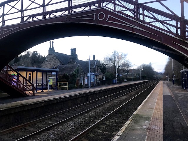
This coast to coast line is one of the oldest in the country which opened to passenger traffic in 1835, and still retaining many distinctive listed features. In the middle of the current rail dispute it now lay sadly deserted, haunted by the dismembered automated voice from platform tannoys telling non existent travellers that no services were running.

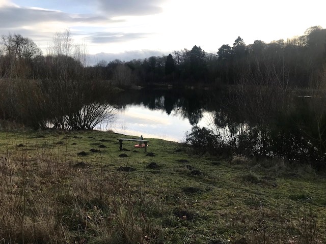
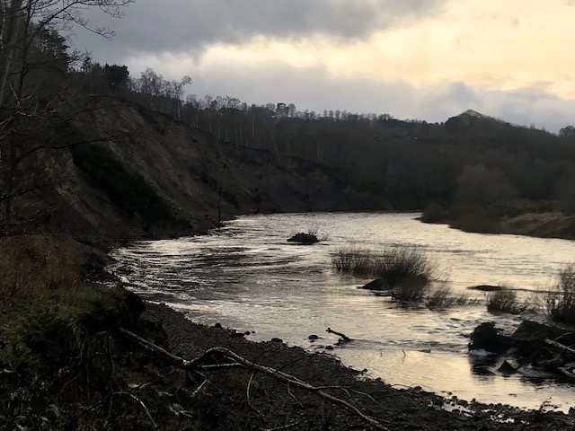
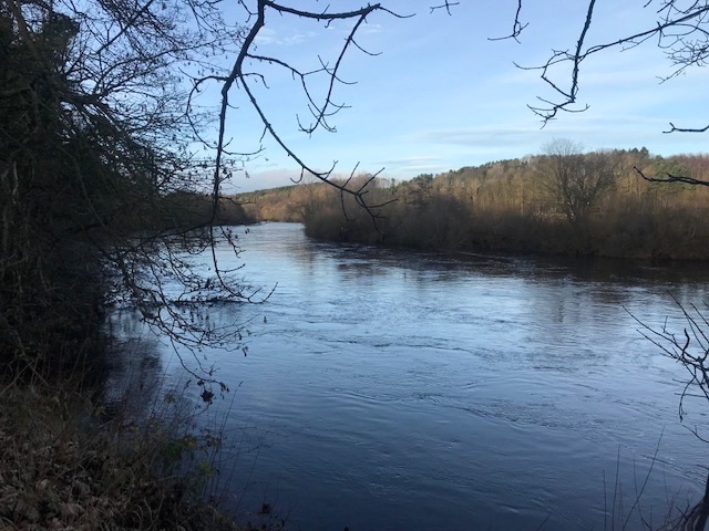
Walk to the end of the Newcastle platform and you slip into a permissive path that leads down to the south bank of the River Tyne, hurrying to keep its appointment with the city and sea. Wide and steep sided at this point in its eastern course, with eddies and strong currents, it’s a great volume of water. On the opposite bank Styford Hall (above) hoved into view, a country house at the foot of the steep escarpment of Abbeybank woods. The 750 acre estate includes arable, pasture, woodland, rented accommodation and fishing rights on both banks.
The Tyne is one of the best rivers in England for salmon and sea trout. Styford share the valuable fishing beats with the Farnley estate on the south bank. The latter is not a syndicate or day let operation but something in between, running 3 – 6 day lets for 2-3 rods in each beat. They’ve also inserted 15 acres worth of ponds and woodlands into the floodplain in recent years, catering for private trout fishing, complete with jetties and boats.

Reminded of Thomas Bewick (1752-1828) whose childhood home at Cherryburn lies just a few miles downriver and about whom I’ve written in these country diaries before. Bewick, like all the menfolk in his family, was a skilled angler who knew the Tyne intimately. The subject of fish and fishermen appeared often in his workshop’s output of woodcuts.
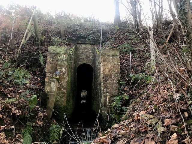
The permissive path we were following upstream crosses the odd minor tributary. Impressed by the sturdy railway architecture, where a simple high arched narrow culvert in the trackbed has been designed to cope with floodwaters.

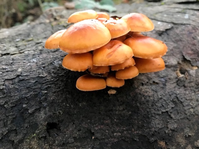
The joys of a quiet winter walk like this include a good selection of fungi that stand out from the mass of inert foliage. From clusters of honey fungus working its way effectively through dead or dying wood to bracket fungi in tree trunks, looking like stuck axe heads. Burrs on trunks too, benign tumours erupting at points in the tree’s growth and caused by fungi, viruses or other stress factors.
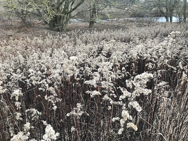
Along the wider grassier bankside wisps of last year’s rosebay willow herb are easily overlooked compared with the denser darker stands of golden rod, which being more closely packed, manage to hold their strong sculptural form.
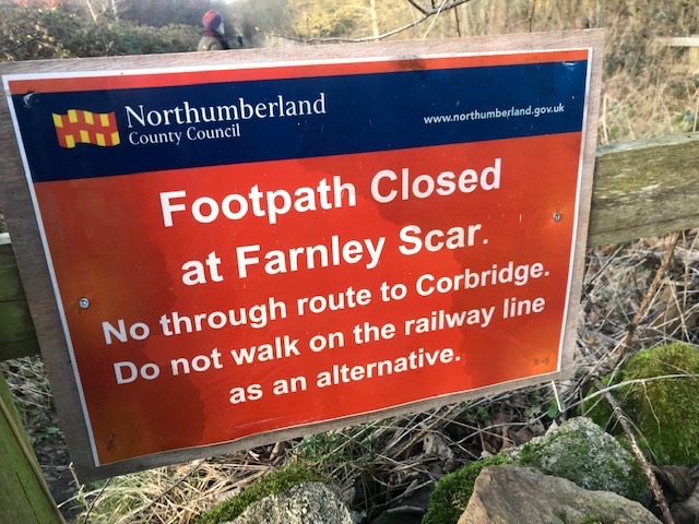
We saw few people on our walk but in lockdown apparently this pathway was very popular with locals taking exercise or walking dogs. The sandy bank had slipped or was lurching in places so some care was needed. Debris suspended in the bare branches of willow alder and birch along the riverbank spoke of flooding too. A decade ago a combination of prolonged heavy rain and an already weakened high bank where the river turned at Farnley Scar below Corbridge resulted in a massive landslide. The public footpath we were following disappeared with it and has still not been replaced.
Those wanting to continue the walk now have no choice but to technically trespass on both private land and the railway track bed. Some do, in part to keep a public right of way pressure on those in authority to resolve the situation by safely re-routing the path so the two communities can be re-united by foot. Clearly there’s a serious lack of agreement between landowner, Network Rail and the county council as to the way forward. This I suspect boils down to who will pay to reinstate the right of way. This is a sad state of affairs that reflects the greater national inability to properly value and protect public access for walkers and ramblers in our countryside.
The statistic that only 8% of England’s rural landscape is accessible to the public comes to mind. Post Covid there’s a groundswell of opinion to grow that dismal figure but the entrenched interests of property and land ownership are unlikely to accommodate demand without a determined governmental will to improve matters and there’s not much sign of that happening any time soon. Meanwhile it’s left for people to take action themselves to assert their common law rights, whatever the risks. Strolling back the way we’d come we were overtaken by a young woman walking her dog. A brief conversation confirmed they’d come from Corbridge by the forbidden route. She smiled and we gave her the thumbs up.
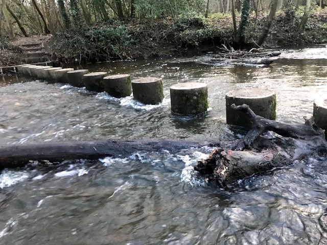
A brief diversion on regaining Riding Mill railway station took us on to where the village’s meandering March Burn joined the Tyne, crossing it via a set of concrete stepping posts. This in turn brought us to a grassed track embedded in the steep original riverbank (a Holloway) heading for the water where it disappears in scrub. My friend Rob suggested there must have been a ford here at some point. Back home I looked it up and indeed that was the case. The crossing fell into disuse when the modern pumping station we could see a short distance downstream raised the river level by a couple of feet.
The ford originally gave access to the village of Styford. Earliest reference to the settlement, part of the barony of a Norman lord called Bolobenc, Earl of Buckingham, date to the C12th. Border warfare ravages stymied its growth and the great flood of 1771 sweep away much of the remaining housing stock. Three decades after that the remains of the settlement were cleared away in a landscaping operation that saw the building of Styford Hall and laying out of accompanying riverside parkland.
