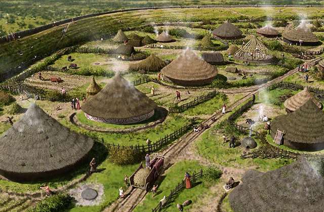
There are over 1200 hill forts in England. Mostly built in the Iron Age, between 900 BC and the Roman Invasion in the first Century AD. Their construction seems to reflect an age of increased conflict fuelled by a growing population, in stronger tribal groupings, disputing rights over land and resources. Some hill forts were built on earlier Neolithic causeway enclosures, some incorporate burial barrows. They all vary greatly in size, form, defensive strength and number of occupants, from a handful of families to a whole community hundreds strong, plus assorted livestock & food stores.
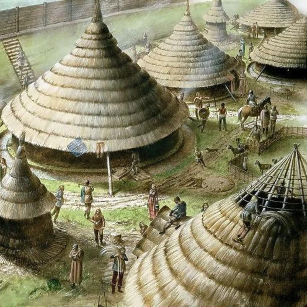
The Roman occupation may have put an end to native tribes setting up fortresses that could threaten imperial rule but some of these distinct man made features were reused beyond their own era. Just up the road from where we were staying, north of the village of Loddiswell which is itself situated on a hillside, there is one such place, and we were keen to pay it a visit.
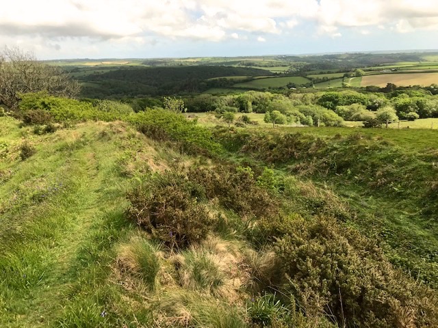
Blackdown Rings, 600 feet above sea level, gives distant views over a wide swathe of South Hams countryside, from Dartmoor to the north, southwards to the coast and slopes down to the valley of the Avon, or Aune, river that physically connects the two. In ancient times this valley would have provided a trade route and rich hunting grounds, so clearly well worth overlooking and hence, controlling. A great location for a defensive settlement atop its gritstone summit.
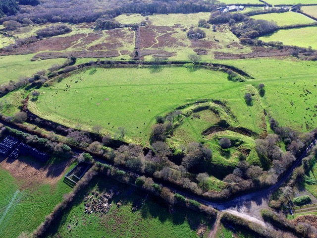
The former fort extends over 6 acres (2.45 hectares) defined by an earthwork rampart with external ditch and counterscarp bank, these days picked out by hawthorn and other tough little trees. What makes it special is that the Normans, following their conquest of England in 1066, adapted the N.W. corner of the site as a motte and bailey castle. Like many a visitor before us we had to ascend the man made mound (motte) to overlook the immediate enclosure (bailey) with the larger original enclosure sloping away beyond. Presumably that wider enclosure would have secured their livestock and supplementary facilities. No permanent settlement evolved over time in this case, that wood walled military command base never became a permanent stone structure and this stretch of high land on hard rock resorted to heath and pasture.

Today ewes and their lambs graze the slopes and the land is owned and managed by a charitable trust named after the site’s former owner Sir Matthew Arundell, whose will of 1591 bequethed it ‘for the good and behoof of the parishioners of Loddiswell.’ Combined with other parish lands the income raised from investments down the centuries support a range of village causes. Here at Blackdown Rings all the information boards were paid for out of the trust’s funds.
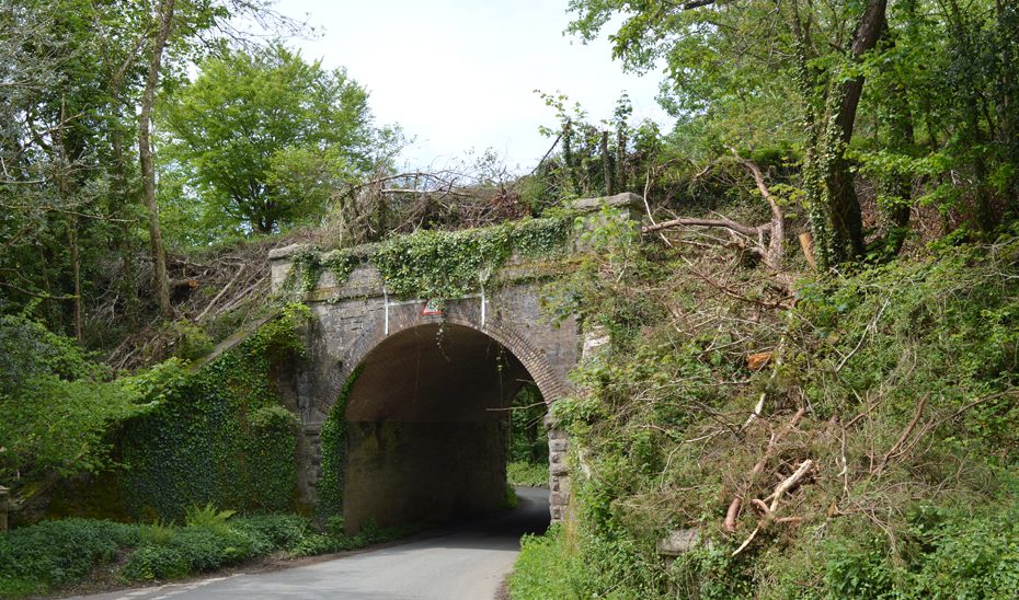
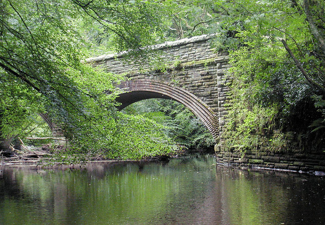
Time caught us short on this holiday or we would have extended the original intention to walk the waymarked paths along the wooded Avon valley at our feet as it has a fascinating modern history. The former railway branch, known as the ‘Primrose Line,’ once wove a scenic journey from its junction with the Plymouth/Exeter mainline at South Brent, via a tunnel into the Avon valley, intertwining with the river and on across to Kingsbridge. Despite a spirited local campaign to turn it into a heritage line the 12 miles of track were raised and removed after closure in 1963, an early victim of the Beeching cuts.
The same era that saw a third of Britain’s rail lines closed down also saw a huge increase in the planting of commercial conifer, encouraged by tax breaks. This was often achieved at the expense of ‘unproductive’ deciduous woodlands that could be cleared to make way for them. Protesters in different locations across the country banded together to oppose the trend and in this corner of Devon local residents led by Kenneth Watkins formed The Woodland Trust to do just that.

Today we were looking over some 344 acres of ancient, semi-natural and newly planted woodlands that the trust own and manage here in the Avon valley. One of those woodlands, the very first to be purchased and saved from clear felling back in 1972, has been re-named Watkins Wood in honour of the charity’s founder. It’s one of 1,000 woods open to the public that the Woodland Trust manage nationwide in 2024, thanks to the combined efforts of its 500.000 members and supporters.
Footnote: Bemused to learn when researching this entry that the top three hill fort hotspots in England are in Northumberland (where I live) with 271 recorded sites, Devon (where grew up) with 89 and Cornwall (where born) with 77. So, plenty more to discover yet!
